Appendix B presents stormwater management policies, best management practice guidelines, and conservation design templates for the County’s two principal watersheds.
Appendix B presents stormwater management strategies at varying scales from individual lots to the entire County. Section 1 describes stormwater best management practices (BMPs) in various categories, including policy/regulations, planning/zoning, stormwater management, and landscaping. These BMPs are appropriate for all development policy areas in the County, though their application may change depending on circumstances. Section 2 illustrates conservation site design templates for various types of developments that may be applied throughout Douglas County. These templates demonstrate how site planning can be used to integrate retention-based stormwater BMPs throughout the development site. A “distributed stormwater management” approach is used rather than a more conventional “end of the pipe” approach.
Stormwater Best Management Practices Tool Box
The Stormwater Best Management Practices Tool Box identifies strategies and provides guidelines for stormwater management and water quality protection practices that may be implemented in Douglas County. The identified BMPs include ecologically and hydrologically sensitive designs, strategies, techniques, and practices that should be included in an overall watershed protection and management program. The stormwater BMPs presented in this section are multidimensional practices that meet traditional water quality and quantity control standards outlined in many stormwater ordinances, as well as achieving planning, urban design, and landscaping objectives.
The BMPs presented in this section are designed to address both the quantity and quality of runoff from developed sites. The sandy soils of parts of Douglas County, especially within the floodplain of the Platte River, provide opportunities and constraints. While infiltration-based stormwater management practices are well suited to these soils, caution must be exercised to prevent contamination of groundwater resources that are an important water source for the County. The keys to preventing groundwater contamination are to limit potentially polluting land uses to those areas least susceptible to groundwater contamination, implementing measures to prevent hazardous materials from coming in contact with rainfall and runoff, and to combine filtration measures with infiltration practices to remove common stormwater pollutants in all developed areas.
The tables on Page 4 and 5 indicate 1) the suitable scales and applicable development types for which each of the BMPs is most appropriate, and 2) the potential effectiveness of each BMP in achieving a number of Douglas County’s goals and objectives. The BMPs are classified into four categories: policy/regulations, planning/zoning, site stormwater BMPs, and landscaping.
The presented stormwater BMPs can either be retrofitted into existing developed areas or integrated into new development through conservation planning and design. Templates that illustrate site level conservation planning and design are provided in Section 2. These BMPs can be used by local authorities, planners, designers, engineers, and developers throughout the County.
Conservation Development and Impervious Area Reduction are critical site-level planning and design strategies to create environmentally sensitive developments to achieve stormwater management and watershed goals.
Policies and Regulations
Policies and Regulations serve as the first step to establish and then enforce minimum standards for natural resource protection and stormwater management. Policies express goals for natural resource, water quality, habitat, and open space protection. Regulations (along with zoning described below) are the tools used to implement the policies. Policy actions or regulations include acquisition of Conservation Easements, Stream/ Wetland Restoration and Management, and adoption of Watershed Development Ordinances.
Planning and Zoning
Planning and Zoning related practices are also used to implement policy goals of maintaining high environmental quality as Douglas County develops. Significant natural features and other areas to be protected are identified using environmental planning processes. Many of these areas can then be protected through open space and other protective zoning.
Site Stormwater BMPs
Site Stormwater BMPs are site-specific practices that minimize on site and off site hydrologic and water quality impacts due to stormwater runoff by attempting to incorporate and re-establish natural hydrologic processes into the built environment. These measures can be designed and implemented in new developments as well as retrofited into existing developments in cost effective ways. Site stormwater BMPs have the capability to significantly improve the quality of stormwater runoff as well as quality of life. The practices discussed here include Bioswales, Filter Strips/Level Spreaders, Green Roofs, Naturalized Detention and Infiltration Trench, Porous Pavement, Rain Barrels/Cisterns, Rain Gardens, and Vegetated Swales.
Landscaping
Landscaping, as a BMP, stands alone in this category due to the importance of vegetation in biodiversity, aesthetics, habitat, cooling of ambient air, nutrient management, and stormwater management. Native landscapes, including native prairies and wetlands, can improve water quality through infiltration and cleansing of stormwater runoff by trapping sediments and removing nutrients. Properly designed landscapes that incorporate native plants and hydrologically- and ecologically- appropriate vegetation can serve to facilitate effective stormwater management while providing wildlife habitat and quality open space.
Stormwater BMP Guidelines
The following pages illustrate each BMP by providing a definition, identifying its applicability, presenting associated benefits, and finally outlining design considerations.
A detailed description of these specific discussion categories follows:
Definition - a brief description of the BMP relative to stormwater management.
Applicability - Where and how each BMP is most applicable. BMP’s are addressed in three aspects: scale, applications, and effectiveness.
Scale
- Watershed/County: Applied at the regional scale such as watershed or County.
- Town/Village: Applied at the municipal or township scale with common zoning authority.
- Neighborhood: Applied at the subdivision development or other sub-municipal scale.
- Lot: Applied within individual residential or commercial development parcels.
Applications
- Retrofit: Applied to existing developed areas, infill, and redevelopment.
- New: Applied to new development.
- Roofs: Applied on roofs or used to treat roof runoff.
- Streets: Applied on or used to treat runoff from public/private streets and roads.
- Driveways: Applied on or used to treat runoff from driveways.
- Parking Lots: Applied on or used to treat runoff from parking lots.
- Lawns: Used to treat runoff from existing open lawns that are commonly planted with turf such as parks, campuses, and individual yards.
- Sensitive Areas: Applied on ecologically sensitive areas such as remnant habitats, floodplains, wetlands, steep slopes, and highly erodible soils.
Effectiveness
- Runoff Rate Control: Practices that control or reduce runoff rates.
- Runoff Volume Control: Practices that control or reduce runoff volumes.
- Physical Habitat Preservation/Creation: Practices that preserve, create, or enhance wildlife habitats.
- Sediment Pollution Control: Practices that remove suspended solids from runoff.
- Nutrient Control: Practices that have the ability to reduce or remove nutrients such as nitrogen and phosphorus from runoff.
- BOD Control: Practices that can remove constituents that exert a Biological Oxygen Demand (BOD) in runoff.
- Other Pollutant Control: Practices that can reduce and remove other pollutants such as heavy metals and petroleum based hydrocarbons.
Benefits - Positive effects that the individual or system of practices perform. Benefits can be specific to stormwater management or be more general to various functions and values related to quality of life for residents of Douglas County.
Design Considerations - Design recommendations and suggestions that should be considered when implementing the specific BMP. Drawings are not illustrated for construction, but rather as general guidance on the components of the practice.
“X”= practices that are applicable to corresponding scale and applications
| Scale | Applications | |||||||||||
|---|---|---|---|---|---|---|---|---|---|---|---|---|
| Stormwater BMP | Watershed / County | Town / Village | Neighborhood | Lot | Retrofit | New | Roofs | Streets | Driveways | Parking Lots | Lawns | Sensitive Areas |
| Conservation Easement | X | X | X | X | X | X | X | |||||
| Stream and Wetland Restoration & Management | X | X | X | X | X | X | X | |||||
| Watershed Development Ordinance | X | X | X | X | X | X | X | X | X | X | ||
| Conservation Development | X | X | X | X | X | X | X | X | X | |||
| Floodplain Zoning | X | X | X | X | X | |||||||
| Impervious Area Reduction | X | X | X | X | X | X | X | X | X | |||
| Open Space / Natural Greenway | X | X | X | X | X | X | ||||||
| Riparian Buffer | X | X | X | X | X | X | X | X | ||||
| Bioswales | X | X | X | X | X | X | ||||||
| Filter Strip / Level Spreaders | X | X | X | X | X | X | X | X | X | |||
| Green Roofs | X | X | X | X | ||||||||
| Naturalized Detention and Infiltration Basins | X | X | X | X | X | X | X | X | X | X | X | |
| Porous Pavement | X | X | X | X | X | X | X | |||||
| Rain Barrels / Cisterns | X | X | X | X | ||||||||
| Rain Gardens | X | X | X | X | X | X | X | |||||
| Vegetated Swales | X | X | X | X | X | X | X | X | X | |||
| Native Landscaping | X | X | X | X | X | X | X | X | X | X | ||
X Applicable
Bear Creek and Bear Lake Watershed Stormwater Management Tool Effectiveness
“H” = High effectiveness; “M” = Moderate effectiveness; “ –“ = Not Applicable
| Effectiveness | |||||||
|---|---|---|---|---|---|---|---|
| Stormwater BMP | Runoff Rate Control | Runoff Volume Control | Physical Habitat Preservation / Creation | Sediment Pollution Control | Nutrient Control | BOD Control | Other Pollutant Control |
| Conservation Easement | - | - | H | - | - | - | - |
| Stream and Wetland Restoration & Management | M | M | H | H | M | M | M |
| Watershed Development Ordinance | H | H | H | H | H | H | H |
| Conservation Development | H | H | H | H | H | H | H |
| Floodplain Zoning | H | - | H | M | - | - | - |
| Impervious Area Reduction | H | H | - | H | H | H | H |
| Open Space / Natural Greenway | - | - | H | - | - | - | - |
| Riparian Buffer | M | - | H | M | M | M | M |
| Bioswales | H | H | - | H | H | H | H |
| Filter Strip / Level Spreaders | M | M | - | H | H | H | H |
| Green Roofs | H | H | - | - | - | - | - |
| Naturalized Detention and Infiltration Basins | H | - | M | H | H | H | H |
| Porous Pavement | H | H | - | H | M | M | H |
| Rain Barrels / Cisterns | - | M | - | - | - | - | - |
| Rain Gardens | M | M | - | - | - | - | - |
| Vegetated Swales | M | M | - | M | M | M | M |
| Native Landscaping | - | H | H | H | H | H | H |
H High effectiveness M Moderate effectiveness – Not applicable
Conservation Easement
Policy / RegulationsPhysical Habitat Preservation/ Creation
Definition. Legal mechanism for landowners to place voluntary restrictions on the future use of their land. Generally requires landowner to sell, permanently relinquish, or donate the rights of development. Tax benefits may be available for some easements.
Benefits. Preserves significant natural features and open space. Protects created/restored natural areas from development and other disturbances. Provides opportunity to protect morphologically and ecologically based corridors that may be more difficult to protect with fixed width buffers in many stormwater ordinances. Can be used as a tool to create interconnected network of open space (i.e., green infrastructure) to improve ecological functioning of overall system.
Design considerations. Conservation easements, along with floodplain/open space zoning, ordinance buffer requirements, and conservation design should be used to preserve and create natural resource networks. Conservation easements are best suited to areas not subject to land use change and therefore cannot readily be protected through the development process. Conservation easements may also be used to protect high quality uplands, such as bluffs and ravines, and other areas not readily protected through zoning and/or stormwater ordinances.
Stream and Wetland Restoration & Management
Policy / RegulationsPhysical Habitat Preservation/ Creation
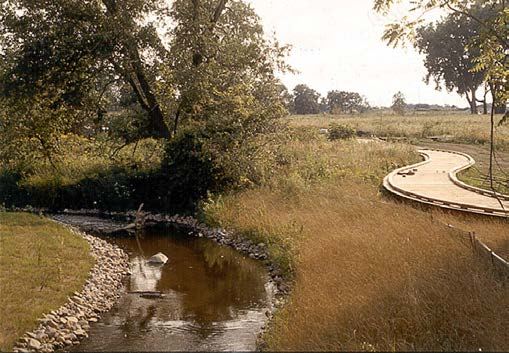
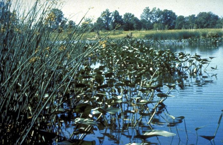
Definition. Practices that maintain a healthy ecosystem and/or restore a deteriorated ecosystem to its natural state. In some cases wetlands are used for stormwater treatment. However, it should be recognized that use of wetlands for stormwater treatment will have a significant negative impact on the floristic diversity of the wetland. For this reason, use of existing wetlands for stormwater treatment is generally discouraged.
Benefits. Preserves significant natural features and their habitat, runoff moderation, and water quality benefits. Reduces the impact to natural systems from floods and other natural perturbations and improves recovery from these disturbances by preserving natural processes and functions.
Design considerations. Conduct a thorough analysis of existing and historic conditions of the restoration site, surrounding area, and watershed to understand system processes and functions. Establish stewardship program with local governments, stakeholders, interest groups, and communities to ensure sustained management and monitoring efforts on managed and restored ecosystems. Management and stewardship activities should be recognized as ongoing activities. Intensity of stewardship activities will decrease as system health and processes are restored.
Watershed Development Ordinance
Policy / RegulationsPhysical Habitat Preservation/ Creation
Definition. Ordinance to regulate development for the purpose of minimizing on site and off site impacts to flooding and water quality. The WDO is an effective means of implementing the stormwater and water quality protection policies, recommendations, and BMPs outlined in Douglas County’s Comprehensive Plan.
Benefits. Provides consistent level of protection throughout watershed. Prevents/minimizes degradation of watershed resources. Establishes orderly rules and procedures for development activities.
Design considerations. Ordinances should comprehensively address stormwater management, floodplain management, stream and wetland protection, and soil erosion and sediment control. Ordinances should include standards to address runoff volumes, runoff rates, and water quality. Ordinances should provide flexibility in methods of meeting standards. Ordinances should encourage watershed resources restoration activities.
Plan ordinance is a critical element of environmental quality control
Conservation Development
Planning / ZoningPhysical Habitat Preservation/ Creation
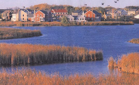
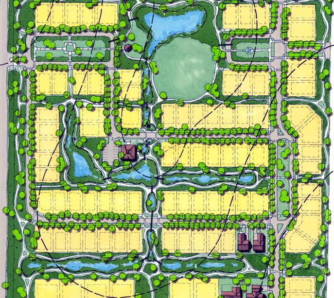
Definition. Site planning and design approach that preserves existing natural areas and utilizes naturalized drainage and detention measures for stormwater management. Section 2 illustrates application of Conservation Development principals for various land uses.
Benefits. Preserves significant natural features and open space. Minimizes changes in runoff volumes, rates, and water quality typically associated with urban development. Improves views, site aesthetics, recreation, and habitat while providing naturalized site drainage and water quality protection.
Design considerations. On site natural areas should be identified and preserved. Existing natural drainage patterns should be incorporated into site plan. Roadways should generally follow ridge lines and natural topography. Impervious runoff should be routed through naturalized drainage systems integrated into the site plan. Use of native vegetation adapted to expected hydrologic conditions will improve runoff reduction and water quality benefits. Naturalized drainage systems should be protected from construction site runoff and sedimentation during establishment.
Floodplain Zoning
Planning / ZoningRunoff Rate Control Nutrient ControlPhysical Habitat Preservation/ Creation
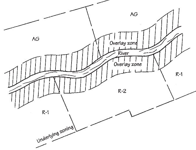
Definition. Zoning regulations established to protect stream corridors and floodplains from urban development and other encroachments. Special conditions should be established for lakefront development within the resource extraction areas of the Platte River floodplain.
Benefits. Preserves stream corridors and riparian wetlands and provides a natural buffer. Enhances safety and quality of life. Protects properties from flood damages. Protects natural floodplain functions, including flood attenuation.
Design considerations. Zoning regulations should allow for and encourage riparian corridor restoration.
Impervious Area Reduction
Planning / ZoningPhysical Habitat Preservation/ Creation
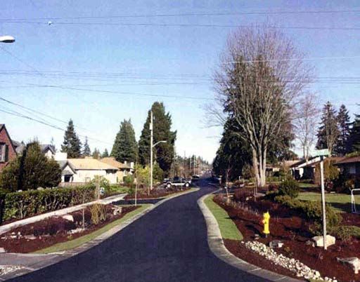
Definition. Impervious area reduction can be achieved by reducing street widths and building setbacks, examining parking lot requirements, and through building design alternatives.
Benefits. Reduces runoff volumes and rates and associated pollutants. Reduces urban heat island effect and thermal impacts to waterbodies. Reduces development and maintenance costs.
Design considerations. Impervious area reductions can be achieved through reduced road widths, shared parking, reduced setbacks, and other measures. These reductions will often require changes in subdivision and other development codes. Street length can often be reduced by clustering development onto portions of the site. Minimize the use of curb and gutter construction that connects impervious surfaces. Benefits of impervious area reduction are enhanced when combined with methods to “disconnect” impervious surfaces (using vegetated swales, bioswales, filter strips/ level spreaders, etc.).
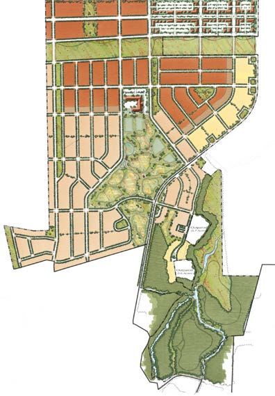
Open Space / Natural Greenway
Planning / ZoningPhysical Habitat Preservation/ Creation
Definition. Designation of interconnected linear open space and/or natural areas as greenways to preserve significant natural features and waterways and to accommodate aesthetic, recreational, and/or alternative transportation uses.
Benefits. Preserves large contiguous natural areas and resources. Provides opportunity for wildlife movement and habitat within an interconnected ecological network. Provides alternative and connected passive recreation and alternative transportation opportunities.
Design considerations. A natural resource inventory should be completed to identify significant natural features, including water features, and functioning ecological networks (i.e., green infrastructure). Significant cultural features should also be integrated into the network, such as the Platte River dike. Buffer requirements, open space/floodplain zoning, conservation easements, and conservation design should be used together to implement greenway networks.
an open space/natural greenway system (green infrastructure) is designated to protect and
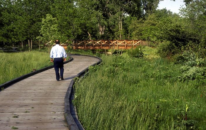
Riparian Buffer
Planning / ZoningPhysical Habitat Preservation/ Creation
Definition. A buffer of native vegetation along lakes, streams, and wetlands that provides water quality and habitat benefits.
Benefits. Preserves and protects natural functions of lakes, streams, and wetlands. Naturally attenuates stormwater flow rates. Provides water quality filtering of lateral surface and groundwater inflows. Helps stabilize streambanks and shorelines against erosion.
Design considerations. Riparian buffer width should be dependent on lake, stream, or wetland quality, ground slope, and size. Buffer should be planted with native riparian vegetation. Buffers can be established and protected through a watershed development ordinance.
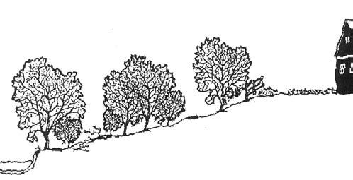
Bioswales
Site Stormwater BMPsPhysical Habitat Preservation/ Creation Other Pollutant Control
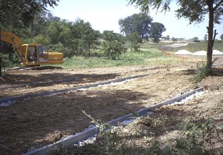
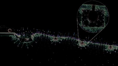
Definition. Vegetated swale system with an infiltration trench designed to retain and temporarily store runoff from impervious surfaces. Bioswales are planted with native grasses and forbs that enhance filtration, cooling, and cleansing of water in order to improve water quality and prevent clogging of infiltrating subsoils.
Benefits. Reduces impervious runoff volumes and rates. Recharges groundwater and sustains stream base flows. Reduces sediment and nutrient runoff. Reduces detention needs when combined with infiltration practices.
Design considerations. Bioswales must be sized and designed to account for drainage area and soils. Filtration benefits can be improved by planting native deep-rooted vegetation. Infiltration storage should be designed to drain within 24 hours to prevent sealing of subsoils. A minimum 12 inch topsoil layer should be provided to protect groundwater quality. The topsoil should have approximately 20% clay, 10% organic material, and 60% sand to provide adequate filtering and infiltration capacity. Bioswales should be protected from construction site runoff to prevent sealing of topsoil and/or subsoils. Direct entry of stormwater runoff into infiltration trench should be prevented to protect groundwater quality and to prevent sealing of subsoils. When necessary, underdrains should be sufficiently low in the trench to provide adequate drainage of aggregate base of adjacent paved areas but sufficiently high to provide infiltration storage.
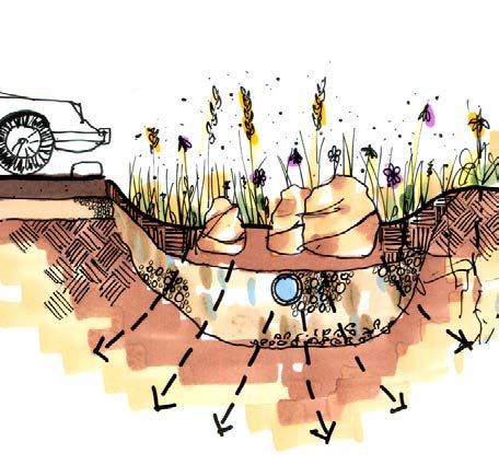
Filter Strip / Level Spreaders
Site Stormwater BMPsPhysical Habitat Preservation/ Creation
Definition. A filter strip is an area with dense, preferably native vegetative cover that is used to filter and absorb runoff, typically from impervious areas. A level spreader is a trench laid on the contour to distribute runoff over filter strip areas.
Benefits. Reduces runoff volumes and rates by allowing runoff to infiltrate over a large area. Recharges groundwater and sustains base flows. Reduces sediment and nutrient runoff. Deconcentrates storm sewer and detention basin discharges to dissipate energy, reduce scour, and better mimic historic runoff patterns to receiving waterbody. Can reduce stormwater detention needs.
Design considerations. Filter strips/level spreaders must be sized and designed to account for drainage area, slope and soils. Chronic hydraulic overloading of filter strips may cause erosion. Filtration benefits can be improved by planting native deep-rooted vegetation and by minimizing the slope. Where untreated stormwater is directly discharged to a level spreader finished in sandy soils, consideration should be given to lining the level spreader trench to prevent contamination of groundwater. Compaction of filter strips should be avoided and/or topsoil should be amended with leaf compost to improve filtration, infiltration and plant establishment. Runoff should be diverted away from filter strips during construction until vegetation is established.
Green Roofs
Site Stormwater BMPsPhysical Habitat Preservation/ Creation
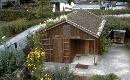
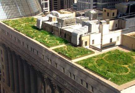
Definition. Vegetated roof system designed to retain and slow rainwater runoff on the top of roofs. Green roofs are generally planted with drought and wind tolerant vegetation.
Benefits. Significantly reduces runoff volumes and rates as well as thermal impacts (50 - 90% reduction in annual runoff ). Can reduce stormwater detention needs. Contributes to reduction in urban heat island effect. Can reduce energy requirements associated with heating and cooling. Creates opportunities for outdoor space as roof top gardens.
Design considerations. Structural load capacity of existing roof system must be evaluated. Plant material, such as succulents that are drought tolerant, should be used on lightweight “extensive” green roof systems. A wider range of vegetation may be used on heavier, “intensive” green roof systems with deeper growing medium. Use of a granular drainage layer will improve retention and detention benefits relative to drain boards.
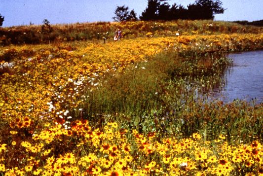
Naturalized Detention and Infiltration Basins
Site Stormwater BMPsPhysical Habitat Preservation/ Creation
Definition. Naturalized detention basins are used to temporarily store runoff and release it at a rate allowed by local ordinances. Infiltration basins temporarily hold water to allow for infiltration. Native wetland and/or prairie vegetation improves water quality and habitat benefits. Naturalized detention and infiltration basins may also be used as a retrofit to achieve water quality and quantity control benefits.
Benefits. Reduces runoff rates and volumes (infiltration basins). Recognized by virtually all stormwater agencies as approved method of controlling stormwater runoff. Very effective at removing sediment and associated pollutants. Provides attractive site amenity when properly designed and not used as sole BMP on sites with high pollutant/ nutrient runoff.
Design considerations. Should be sized to control release to allowable rate. For infiltration basins, a minimum 12 inch topsoil layer should be provided to protect groundwater quality. The topsoil should have approximately 20% clay, 10% organic material, and 60% sand to provide adequate filtering and infiltration capacity. Infiltration basins should be protected from construction site runoff to prevent sealing of topsoil and/or subsoils. Water level fluctuations should be limited to 3-4 feet (during 100-year storm) to maximize plant diversity. Shouldow water entry slopes (for wet basins) will minimize shoreline erosion, improve water quality benefits, increase aquatic habitat and plant diversity, and provide a safety ledge. May be used as retrofit along stream corridors to prevent direct discharge of stormwater runoff.
Porous Pavement
Site Stormwater BMPsRunoff Rate Control Nutrient ControlPhysical Habitat Preservation/ Creation
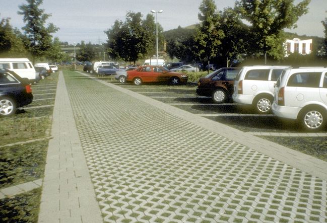
Definition. Permeable or perforated paving materials and pavers with spaces that allow transmission of water to aggregate base and subsoils. Runoff is temporarily stored in the base for infiltration into the subsoils and/or slow release to storm drain system.
Benefits. Reduces runoff volumes and rates. Recharges groundwater and sustains base flow. Filters sediments and associated pollutants from runoff. Can reduce stormwater detention needs.
Design considerations. Base and subbase materials should be coarse aggregate with no fines to allow adequate drainage and prevent frost heave. Subgrade should be graded at minimum 1% slope to allow drainage when water entry rate exceeds infiltration capacity of subsoils. Subsoils should be compacted to the minimum level necessary to achieve structural stability. Geotextiles should be used between base and subgrade to improve structural stability and separate base from subgrade. Underdrains should be placed at edge of pavement to provide drainage as necessary to prevent ponding in the base for periods greater than 24 hours. Permeable paving may not be appropriate for areas sensitive to groundwater contamination and for land uses utilizing or storing hazardous materials.
Rain Barrels / Cisterns
Site Stormwater BMPsPhysical Habitat Preservation/ Creation
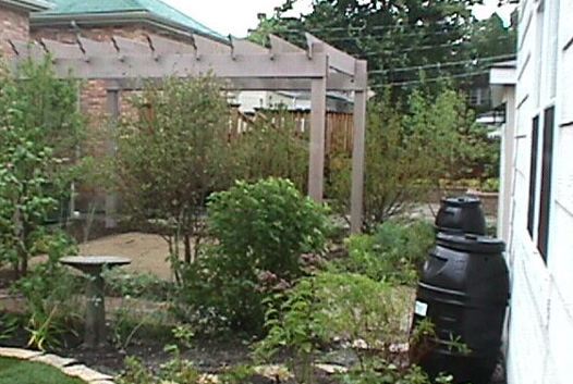
Definition. A vessel used to capture and temporarily store rainwater runoff from impervious surfaces such as roofs for various uses, including greywater reuse and irrigation.
Benefits. Reduces runoff volumes. Conserves water for reuse (e.g. irrigation).
Design considerations. At the residential scale, rain barrels located at rooftop downspouts will typically be used. One inch of rainfall over 1,000 square feet of roof area is equivalent to 625 gallons of rainwater. Rain barrels can be used in combination with rainwater gardens, green roofs and other stormwater BMPs to increase stormwater benefits. Larger cisterns in some settings may be used to provide greywater for use in toilet flushing and other non-potable uses.
Rain Gardens
Site Stormwater BMPsPhysical Habitat Preservation/ Creation
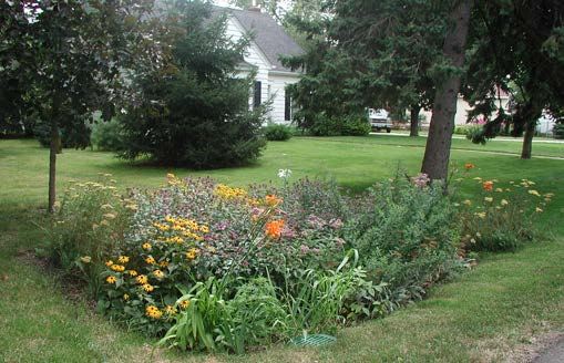
Definition. A landscaped garden designed to retain and detain stormwater runoff from individual lots and roofs.
Benefits. Reduces runoff volumes and rates from lawns, roofs, and driveways. Recharges groundwater and sustains stream base flows. Reduces sediment and nutrient runoff. Can reduce stormwater detention needs. Can increase aesthetic value of properties. Can provide wildlife habitat.
Design considerations. Rainwater gardens must be sized and designed based on drainage area, soils, and desired runoff volume reduction. Filtration and nutrient control benefits can be improved by planting native vegetation. The soils in the top 12” to 18” should be amended with leaf compost to enhance organic content and improve filtration of stormwater runoff. Where subsoil infiltration rates are low (less than 0.5 to 1.0 in/hr), a gravel trench with underdrain should be used to encourage drainage between events. The rain garden should be designed to drain within 24 hours to maintain aerobic conditions and vegetative health.
Vegetated Swales
Site Stormwater BMPsPhysical Habitat Preservation/ Creation
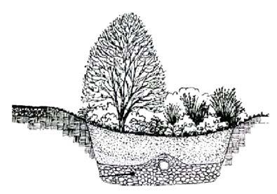
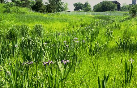
Definition. Vegetated swales are planted stormwater features that convey, retain, infiltrate, and cleanse stormwater. Swales planted with native, deep-rooted vegetation function better than those planted with turf grass.
Benefits. Reduces runoff volumes and rates. Provides conveyance and water quality benefits in one stormwater feature. Reduces sediment and nutrient runoff. With proper design, can reduce detention needs.
Design considerations. Vegetated swales must be sized to convey design runoff rate (typically 10-year storm). Filtration benefits can be substantially improved by planting native deep-rooted grasses and forbs and by minimizing the slope. Topsoil may be amended with compost to improve organic content for filtering and to improve infiltration and retention of runoff. Vegetated swales should be protected from construction site runoff to prevent sealing of topsoil and/or subsoils.
Native Landscaping
LandscapingPhysical Habitat Preservation/ Creation
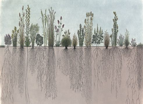
Definition. Establishment of native vegetation in either large restoration projects or smaller gardening projects. Native landscaping is often a component of other BMPs such as detention and infiltration basins, filter strips, bioswales, and rainwater gardens.
Benefits. Reduces runoff volumes. Increases infiltration rates. Increases ability to remove nutrients. Increases organic content of soils. Increases permeability of compacted soils. Reduces irrigation, fertilization, and pesticide requirements. Reduces use of fossil fuels and air pollution relative to turf landscapes that require regular mowing and maintenance. Provides wildlife habitat.
Design considerations. Some local “weed” ordinances may need to be amended to allow native and taller vegetation. Plant diversity and health is maximized by annual burning. Plots may be mowed and then burned to prevent spread of fire on small sites. On compacted soils, amendment may be necessary to increase organic content, improving success of establishment.
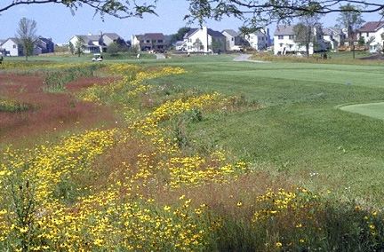
CONSERVATION DESIGN TEMPLATES This section provides site scale "Templates" that demonstrate application of the stormwater BMPs and techniques described in Section 1 within different Douglas County land use scenarios.
The templates are generally 40-acre sites and are designed to illustrate conservation-based development and land management techniques and to contrast those techniques to more typical conventional development. The concepts illustrated in these templates are transferable to most development plans with modifications for local conditions and land characteristics.
The terms "conservation" and "conventional" are used throughout this section in reference to the various site planning and stormwater techniques utilized on development projects. "Conservation" refers to techniques and BMPs that are based on ecologically sensitive design and planning principles. Conservation templates combine various sustainable design concepts with such names as "green design", "low-impact development", "sustainable development", "ecological design", "smart growth", and others. Conservation development uses site planning techniques to protect on site sensitive areas and distributed stormwater management techniques that integrate runoff management throughout the site plan. These strategies are designed to integrate stormwater, habitat, livability, restoration, and other ecological goals to achieve overall superior site plans.
"Conventional" is the second design descriptor used in this section, and refers to practices that are typically being utilized in land development and building construction today. Even though conservation and conventional designs are both allowed by code, conventional designs and techniques are seen most often, and thus represent the default designs and practices for a majority of communities and developments. Conventional developments rarely consider ecological health and the other goals of this project, beyond the minimum necessary to meet regulatory requirements.
The templates are provided to help guide local authorities, land owners, and designers implement the stormwater BMPs described in Section 1. The seven templates discussed in this section are:
- Commercial/Industrial
- Moderate Density Residential
- Rural Residential
- Estate Residential
- Agricultural
- Stream Corridors
- Bluff and Ravine
- Lakes and Wetlands
The relative cost of conservation development versus conventional is highly dependent on the specifics of the development site and the design characteristics of the plan. However, studies indicate that the cost of conservation development can be less than conventional at several levels. A cost comparison of the templates presented in this section shows that the conservation versions of the commercial and residential templates have lower expected construction costs relative to the conventional versions. 1 A study on the public fiscal impact of conservation design indicates that conservation development should generally have a greater positive impact on public revenues vs costs than conventional development. 2 Finally, another study indicates that conservation development that increases retention of stormwater runoff should have a positive impact on the economy due to reduced flooding and improved water quality as well as reduced infrastructure cost and increased aquifer recharge. 3
Changing Cost Perceptions: An Analysis of Conservation Development, County, Illinois, Center for Governmental Studies, Northern Illinois The Downstream Economic Benefits of Stormwater Retention, Department of Agriculture and Consumer Economics, University of
For each land use or ecosystem template, two versions are provided: 1) a conventional template using current default or standard-of-practice site design and planning techniques, and 2) a conservation template, which uses environmental design principles and integrated best management practices for stormwater management. Both templates in each land use category have been designed with identical numbers of units, commercial square footage, etc., but are arranged and organized in different ways over the site, and use different stormwater management and landscaping techniques.
Although the site planning and stormwater management concepts illustrated in the conservation templates can be applied to development sites, the templates should not be viewed as "stencils" to be "stamped" across the watershed. A significant element of conservation design is adapting the site and stormwater plan to the specific conditions of the site.
General environmental design principles are incorporated into the example urban conservation templates to protect and/or enhance stormwater quality.
1.
Development avoids natural features to the extent possible, including streams, wetlands, remnant natural areas, and critical habitats. Water features are protected, buffered, linked, enhanced, and restored where possible. The site plan respects site topography, utilizing natural drainage patterns to minimize the need for built infrastructure. Clustering of built areas, a range of lot sizes, and other design techniques are used to create views, privacy, and amenities for each home site. This facilitates protection of site natural areas, integration of naturalized stormwater management systems, and linked habitat areas, while also leading to efficient
2.
3.
4.
utilization of site topography and provisions for common open space. Created native landscapes are integrated as part of the stormwater management system to utilize their natural filtration, infiltration, storage, and transpiration processes as well as their habitat and aesthetic benefits. Where appropriate, engineered systems based on natural processes are utilized as part of the stormwater management system for the purpose of enhancing groundwater recharge, stabilizing site and regional hydrology, and minimizing irrigation needs. Stormwater is managed as close to its source as feasible to take advantage of the area permeable soils to emulate existing conditions. Conservation site planning and design techniques used in the templates are generally cost-effective and have been used and proven in existing developments.
5.
6.
7.
8.
The focus of these principles is on protection of aquatic habitat from the direct and indirect impacts of development and prevention of flooding and streambank erosion. Other natural resoruces can be protected using the same principles and practices.
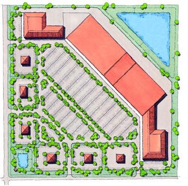
The Conventional Template is laid out as a typical strip mall, with two “big box” retail establishments, isolated outlet shops, parking, landscaping, and stormwater detention according to code.
BMPs Applied in the Conservation Template
Conservation Easement Stream/Wetland Management and Restoration Watershed Development Ordinance
Planning/Zoning Conservation Development Floodplain Zoning Impervious Area Reduction Open Space/Natural Greenway Riparian Buffer
General Character
Commercial/industrial developments include retail, light industrial and offices in various scales from large scale “big box” retail stores, to light industrial and office park development, to smaller scale restaurants, shops, and individual offices.
Conservation Design Templates Commercial/Industrial
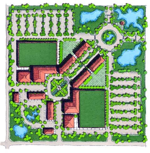
Like the Conventional Template, the Conservation Template has two “big box” retail stores, but in the conservation design, they have green roofs and are designed as part of a “Main Street” retail setting with second floor mixed-use areas, a plaza, and both on-street and lot parking. Permeable paving systems are used in the parking lots along with stormwater infiltration bioswales as part of a naturalized and landscaped stormwater system.
Site Stormwater BMPs Bioswales Filter Strips/Level Spreaders Green Roofs Naturalized Detention and Infiltration Trench Porous Pavement Rain Barrels/Cisterns Rain Gardens Vegetated Swales
Conservation Design Templates Moderate Density Residential General Character
Moderate density residential development is defined for this project as having a gross density of approximately 2 units per acre with lot sizes ranging from 6,000 to 15,000 square feet with municipal water and sewer service. Typically, these developments are under municipal jurisdiction, but may occur in unincorporated areas as part of planned unit developments (PUD’s).
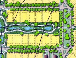
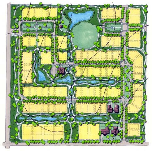
The Conservation Template includes narrower streets and an integrated, naturalized stormwater system that hosts trails and public open space and allows every residence to back to open space.
BMPs Applied in the Conservation Template
Conservation Easement Stream/Wetland Management and Restoration Watershed Development Ordinance
Conservation Development Floodplain Zoning Impervious Area Reduction Open Space/Natural Greenway Riparian Buffer
The Conventional Template includes wide roads, no public open space, and storm sewers discharging into turf and/or rip-rap lined detention basins.
Site Stormwater BMPs Bioswales Filter Strips/Level Spreaders Green Roofs Naturalized Detention and Infiltration Trench Porous Pavement Rain Barrels/Cisterns Rain Gardens Vegetated Swales
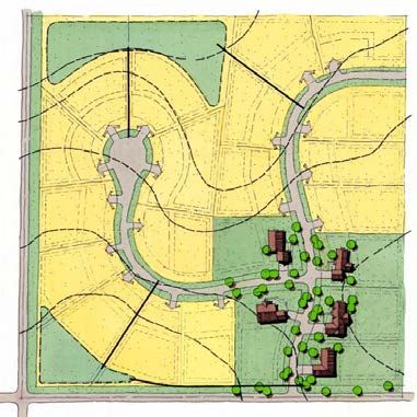
The Conventional Template includes a cul-de-sac drained with storm sewers discharging into detention basins.
BMPs Applied in the Conservation Template
Conservation Easement Stream/Wetland Management and Restoration Watershed Development Ordinance
Planning/Zoning Conservation Development Floodplain Zoning Impervious Area Reduction Open Space/Natural Greenway Riparian Buffer
General Character
The Rural Residential Template is defined as having lots averaging approximately 1.25 acres, a gross density of 0.55 units per acre, served by private wells and septic systems. Typically, rural residential development is limited to unincorporated areas. However, more recently, many developments of this density have come under municipal jurisdiction, and would then often be served by municipal water and sewer.
Conservation Design Templates Rural Residential
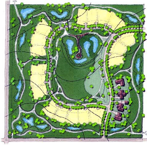
The Conservation Template includes a narrow lane and a naturalized stormwater system that utilizes the landscape to filter and absorb runoff as well as providing walking and biking trails.
Site Stormwater BMPs Bioswales Filter Strips/Level Spreaders Green Roofs Naturalized Detention and Infiltration Trench Porous Pavement Rain Barrels/Cisterns Rain Gardens Vegetated Swales
Conservation Design Templates Estate Residential General Character
Estate residential development is defined as having lots averaging approximately 2.5 acres in size, a gross density of approximately 0.2 units per acre, served by private well and septic systems. This large lot development may be appropriate for some parts of Douglas County.
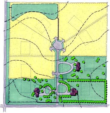
The Conservation Template has shorter driveways and uses native plantings and a conservation easement. The Conservation Template disturbs the minimum amount of land necessary to install the roads, houses, and septic systems. The remainder is undisturbed or is restored.
BMPs Applied in the Conservation Template
Conservation Easement Stream/Wetland Management and Restoration Watershed Development Ordinance
Planning/Zoning Conservation Development Floodplain Zoning Impervious Area Reduction Open Space/Natural Greenway Riparian Buffer
Site Stormwater BMPs Bioswales Filter Strips/Level Spreaders Green Roofs Naturalized Detention and Infiltration Trench Porous Pavement Rain Barrels/Cisterns Rain Gardens Vegetated Swales
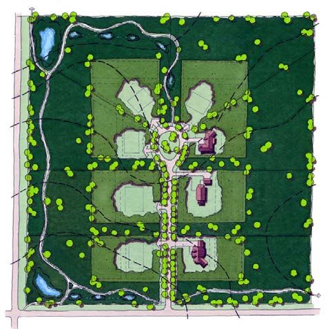
The Conventional Template is typical row-crop agriculture that includes the use of herbicides, pesticides, tillage of the soil, and mono-crop production. Farming is practiced to the edge of the stream or drain.
BMPs Applied in the Conservation Template
Conservation Easement Stream/Wetland Management and Restoration Watershed Development Ordinance
Planning/Zoning Conservation Development Floodplain Zoning Impervious Area Reduction Open Space/Natural Greenway Riparian Buffer contour plowing, perennial crops, or grazing
General Character
Agricultural lands are cultivated and manipulated for the production of food crops and/or livestock for sale beyond the immediate use of the farmer or landowner.
Conservation Design Templates
The Conservation Template includes a variety of techniques and environmentally sound agricultural practices that can improve the hydrology and water quality of the County. These practices include contour plowing, native seed production, reduced or no-till techniques, organic farming, biodynamic or permaculture techniques, animal grazing on native grassland, and buffer zones.
Site Stormwater BMPs Bioswales Filter Strips/Level Spreaders Green Roofs Naturalized Detention and Infiltration Trench Porous Pavement Rain Barrels/Cisterns Rain Gardens Vegetated Swales
Agricultural
Conservation Design Templates Stream Corridors General Character
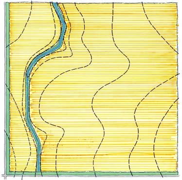
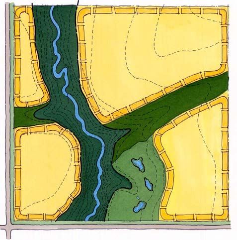
Stream corridors are linear spaces along streams, creeks, and rivers that are protected and serve multiple functions including habitat and recreation. Conservation Template
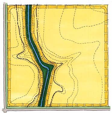
The Conservation Template depicts a healthy stream corridor with the freedom to meander naturally and includes wetlands and floodplains adjacent to the stream. The developed areas represent lands that may be agricultural or urban land uses. Developed areas in the conservation version will have little impact on the stream provided that the management practices outlined in the conservation versions of the urban and agricultural templates are used. Level spreaders and filter strips should be used dissipate the energy of concentrated stormwater runoff and eliminate point discharges.
BMPs Applied in the Conservation Template
Conservation Easement Stream/Wetland Management and Restoration Watershed Development Ordinance
Planning/Zoning Conservation Development Floodplain Zoning Impervious Area Reduction Open Space/Natural Greenway Riparian Buffer
The Conventional Template represents a degraded stream corridor, which has been channelized and often includes no natural buffer. Development is maximized to the edge of the stream corridor.
Site Stormwater BMPs Bioswales Filter Strips/Level Spreaders Green Roofs Naturalized Detention and Infiltration Trench Porous Pavement Rain Barrels/Cisterns Rain Gardens Vegetated Swales
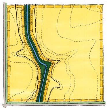
The Conventional Template illustrates how the slopes and ravines, the areas most deserving of protection and restoration, are developed without regard to the natural ability of the land to support such development.
BMPs Applied in the Conservation Template
Conservation Easement Stream/Wetland Management and Restoration Watershed Development Ordinance
Planning/Zoning Conservation Development Floodplain Zoning Impervious Area Reduction Open Space/Natural Greenway Riparian Buffer
General Character
Bluffs and ravines generally occur on the edges of floodplains and are susceptible to erosion and degradation from development. Some of the best remnant natural ecosystems in Douglas County occur within these bluff and ravine areas.
Conservation Design Templates Bluff and Ravine
The Conservation Template depicts urban or agricultural development on top of the bluffs rather than along the slopes and in the ravines. Developed areas in the conservation version will have little impact on the ravine systems provided that conservation practices are used. Level spreaders and filter strips should be used dissipate the energy of concentrated stormwater runoff and eliminate point discharges, especially to the highly erodable ravines.
Site Stormwater BMPs Bioswales Filter Strips/Level Spreaders Green Roofs Naturalized Detention and Infiltration Trench Porous Pavement Rain Barrels/Cisterns Rain Gardens Vegetated Swales
General Character
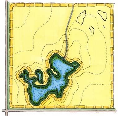
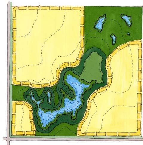
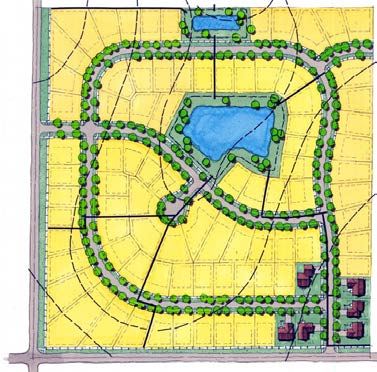
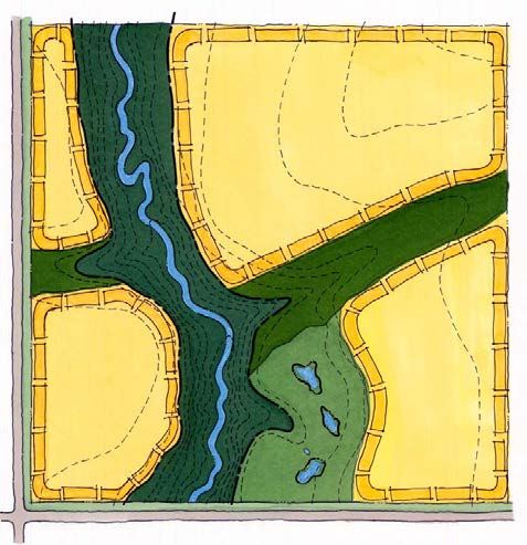
Lakes and wetlands are generally located where the ground drops below the water table, either naturally or, in the case of the Platte River floodplain, by excavation. Lakes also occur where the flow of water has been obstructed. The areas in yellow represent developed areas for agricultural or urban land uses, including lakefront residential development as in Douglas County.
In the Conservation Template, developed areas utilize the practices outlined in the conservation versions of the other templates. These developed areas in the conservation version will have little impact on the water resrouces provided that the management practices outlined in the conservation versions of the urban and agricultural templates, including natural buffers, are used. Level spreaders and filter strips should be used dissipate the energy of concentrated stormwater runoff and eliminate point discharges.
BMPs Applied in the Conservation Template Conservation Design Templates Lakes and Wetlands
Conservation Easement Stream/Wetland Management and Restoration Watershed Development Ordinance
Planning/Zoning Conservation Development Floodplain Zoning Impervious Area Reduction Open Space/Natural Greenway Riparian Buffer
In the Conventional Template, land uses surrounding the lake or wetland reduce the quality of that resource due to polluted stormwater runoff and a much greater amount of surface runoff, both of which can impact groundwater. A very narrow buffer surrounds the lake.
Site Stormwater BMPs Bioswales Filter Strips/Level Spreaders Green Roofs Naturalized Detention and Infiltration Trench Porous Pavement Rain Barrels/Cisterns Rain Gardens Vegetated Swales