A basic principle of the land use plan for the Douglas County planning jurisdiction is the need to establish a balance between environmental values and reasonable development demands. A corollary to this principle is matching development policy to environmental attributes, placing a value on conserving the region’s most important natural resources and assets. This chapter includes a series of maps that identify and locate these vital assets. These maps are then used to establish specific development policy districts to guide land use decisions and project design.
The Douglas County Planning Jurisdiction: A Geographic Overview
The 56 square mile planning jurisdiction can be divided into three environmental districts: the northern uplands, the Elkhorn bluffs, and the river plains.
The northern uplands includes the northeast part of the planning area, bounded by the Elkhorn bluff environment on the west and the Omaha and Bennington planning jurisdictional limits on the south and east. This area is characterized by a rolling terrain and generally drains to the southeast via the Papio Creek system. The largest of these drainageways is the Big Papio Creek, extending northwest from Bennington. Bedrock in this area is deep, generally situated more than 100 feet below the surface.
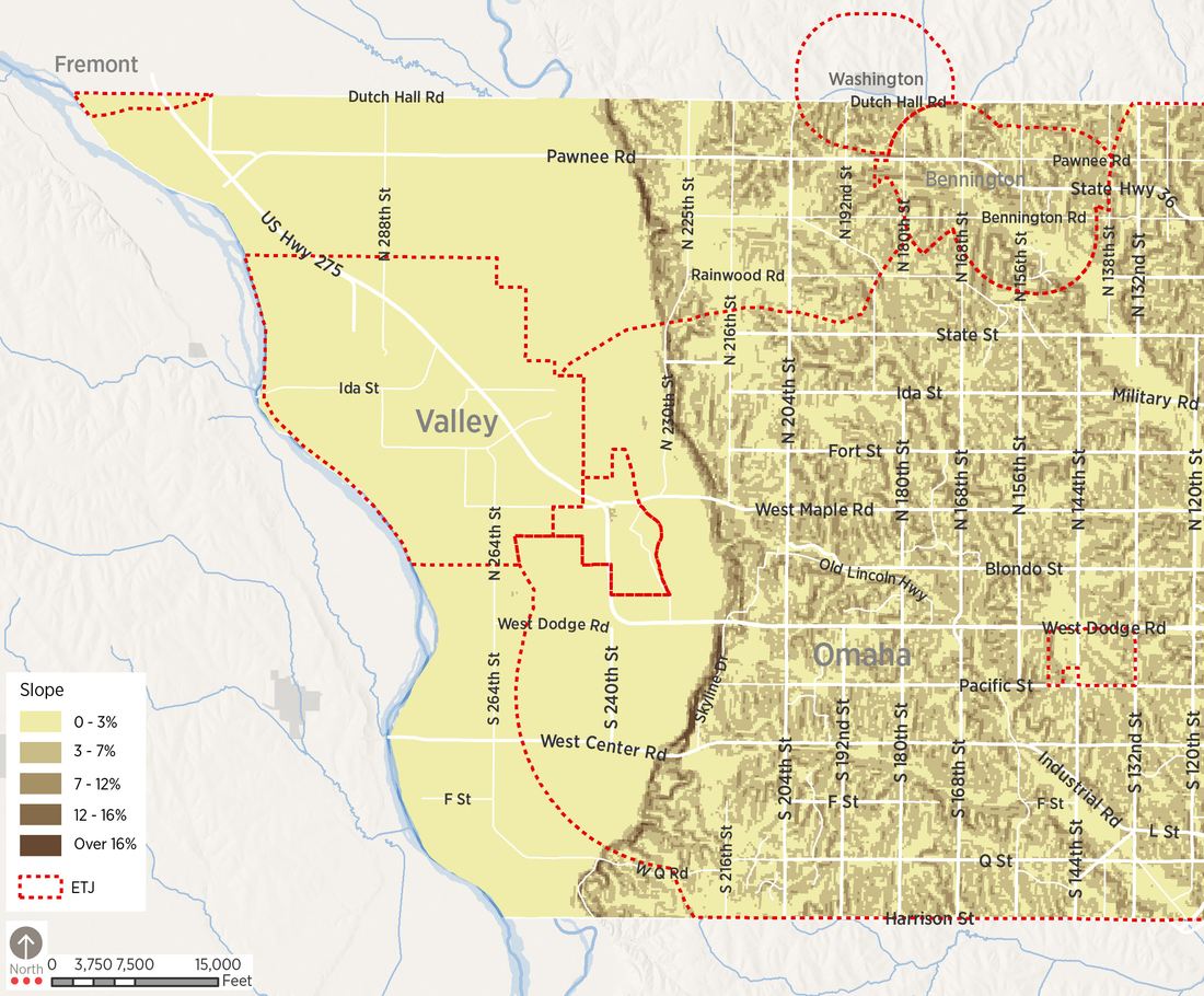
The Elkhorn bluffs area includes a relatively narrow corridor along or east of the Elkhorn River. This region is characterized by steep slopes, in some cases exceeding 15% grades. In some parts of this geographic region, relatively sheer bluffs rise above the river. The corridor forms a boundary between the rolling hills that characterize much of the Omaha metropolitan region and the flatlands associated with the Platte River valley. In general, soils in this region are poorly suited to agriculture because of slopes and poor soils. Soils are subject to erosion if disturbed or if vegetation, most notably prairie/grass lands, is removed.
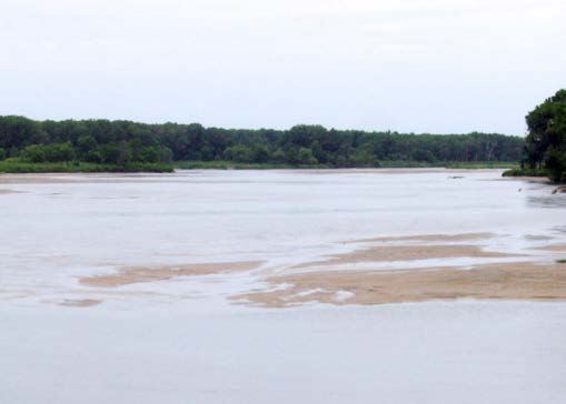
The river plains extend from the edge of the Elkhorn bluffs west to the Platte River. The river plains region makes up most of the current planning jurisdiction. This area is relatively flat, and much of the land area is located within 100- and 500-year floodplains of the Elkhorn and Platte Rivers. In the northern part of the area, Rawhide Creek and Big Slough drain land to the southeast into the Elkhorn. Drainage patterns are less clearly defined to the south. Soils vary in their physical properties; significant sand and gravel deposits occur in these alluvial soils, resulting in gravel extraction uses in parallel to the Platte River floodplain. Soil conditions and high-water tables make the area ideal for resource extraction and agricultural uses.
Environmental Conditions
The First Principles, presented in detail in Chapter Four, indicate that development, while important to the future of the County, should respect the County’s environmental resources. Ultimately, these resources and constraints should limit development to certain areas and preserve the natural character of the County. Therefore, evaluation of environmental conditions and constraints in the County’s planning jurisdiction are the building blocks in the development of the County’s future land use.
To define areas of significant environmental value and limitation, the planning process includes an environmental analysis based on the work of the landscape architect and planner Ian McHarg. The McHargian analysis identifies and maps areas affected by specific environmental issues and limitations, and overlays these factors to define areas in which development has reduced environmental impact. The premise of this analysis is that, other things being equal, unconstrained areas can support greater development densities while areas of significant limitation or special value should be developed at very low intensities or remain in open uses.
Factors that were evaluated included:
- Floodways. These areas represent the primary channels of rivers in flood conditions. Most land use regulation prohibits development within floodways and requires that these channels be kept free of obstruction. The Platte River floodway in the north is contained on the west side of Union Dike and remains narrow in the south.
- Floodplains. Most of the land area within the river plains region is designated as 100-year floodplain. These are areas that have a 1% probability of inundation during any given year. Contemporary floodplain regulations require elevation of finished floor levels one foot above the 100-year flood level. Some areas in the northern part of the planning jurisdiction are located at slightly higher elevations within a 500-year floodplain. These areas have a 0.2% probability of inundation during any given year.
- Levees. The planning jurisdictions’ primary flood control levee is the Union Dike, managed by the Papio- Missouri River Natural Resources District. The dike begins approximately at Highway 92 and extends north into Dodge County.
- Streams and Drainageways. The Platte and Elkhorn Rivers are dominant features in the landscape of the planning area. Land east of the Elkhorn bluffs in the north part of the jurisdiction is drained by the Papillion Creek tributaries running from northwest to southeast. Major drainageways, including Rawhide Creek and Big Slough, also provide defined waterways from the northwest part of the jurisdiction to the Elkhorn River. Preservation of natural drainage corridors is an important environmental priority of this, and past plans.
- Ridges. Ridgelines provide excellent views into the surrounding countryside of the rolling northeastern part of the County planning jurisdiction. Major ridges generally run between 216th and 225th Streets east of Elk City, and in an east-west direction from the Elk City ridge along Rainwood Road and State Street; and along Bennington Road, splitting around one of the Big Papio Creek tributaries between Bennington Road and Highway 36. While these ridges create excellent building sites, they also provide important opportunities for viewsheds and rural preservation.
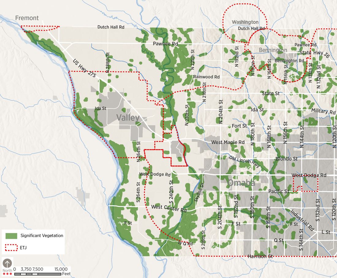
- Significant Vegetation. Areas of Significant Vegetation occur at specific locations along the Elkhorn and Platte Rivers. These areas, which are composed mostly of heavy tree cover, are found along the river corridors and in the Elkhorn bluffs, particularly near Elk City in the north and the bluffs east of the river to the south.
- Steep Slopes. Slopes more than 11% are found on the face of bluffs on the east boundary of the Elkhorn River valley. These slopes are very erodible; thus, land disturbing activities here should generally be avoided. In determining environmentally-sensitive areas, soil types with slopes greater than 12% were considered environmentally constrained because of the amount of site grading that is necessary for these areas.
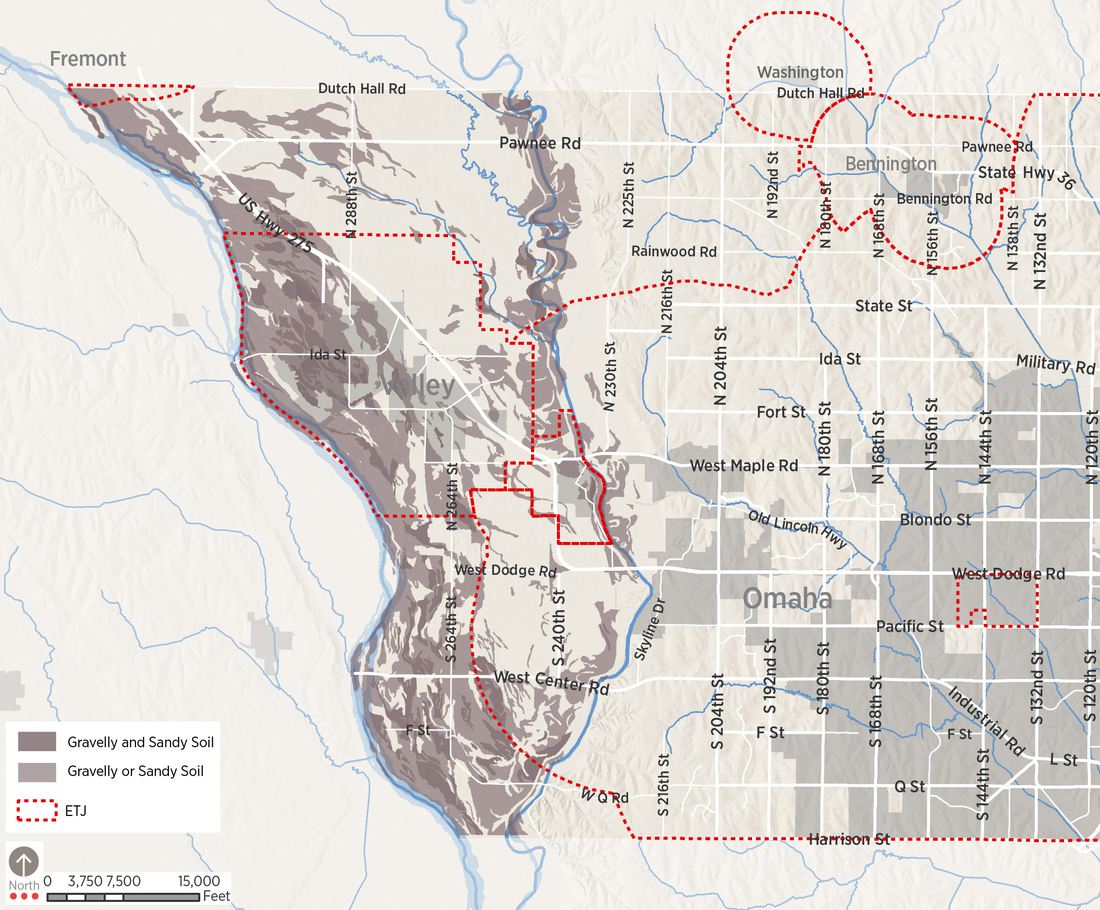
- Sand and Gravel Soils. Areas within both the Platte and Elkhorn floodplains provide opportunities for sand and gravel extraction. Most of this is concentrated in the western portions of the County roughly within the Platte Floodplain. Soil composition in this area provides higher quality and quantity of these resources and is an important regional commodity.
- Wetlands and Hydric Soils. Wetlands, as identified in the most current National Wetlands Inventory (NWI) maps, occur in spotted locations in the river plains portion of the planning jurisdiction. However, many important wetlands resources in the County are not incorporated into the NWI. Specific project applications must include an inventory of wetlands on sites.
- Hydric soils are frequently saturated during the growing season and are typically flooded. Hydric soils, along with vegetation attracted to wet environments and hydrology, are used to define wetlands. These maps provide a detailed inventory of wetlands within the County. Determining this type of natural feature requires a site-by-site analysis.
- The Environmental Overlay/Constraints is created when these critical environmental features are overlaid. These include slope, wetlands, hydric soils, vegetation, floodplain, and floodway. In the composite, areas in the lightest color present the fewest limits to development, while those in darker shades present greater challenges. The most environmentallyconstrained area is easily defined beginning with the Elkhorn bluffs on the east then moving into the floodplains of the Elkhorn and Platte Rivers. These areas encompass a large portion of the County and create both unique opportunities and challenges.
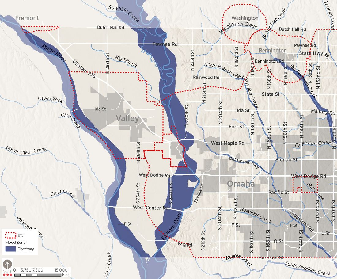
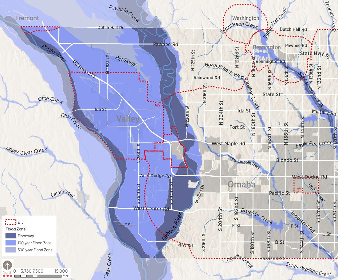
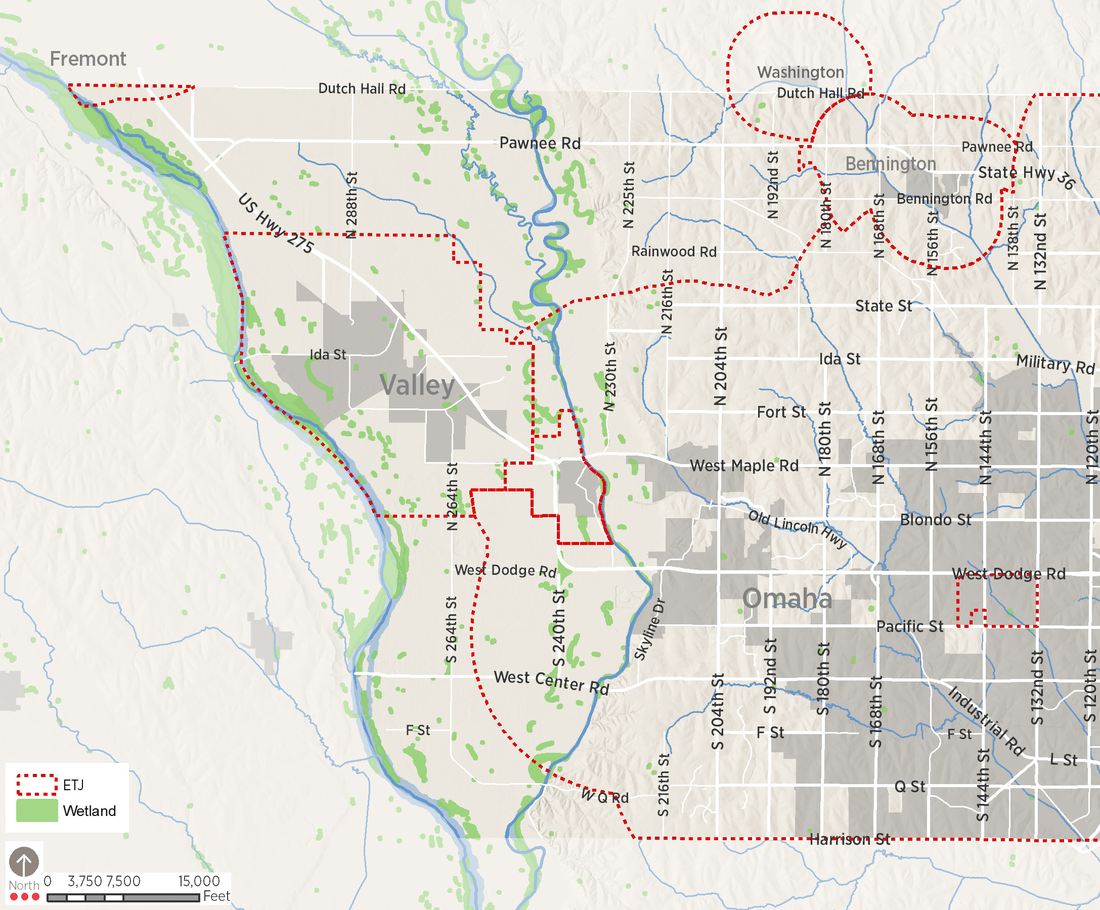
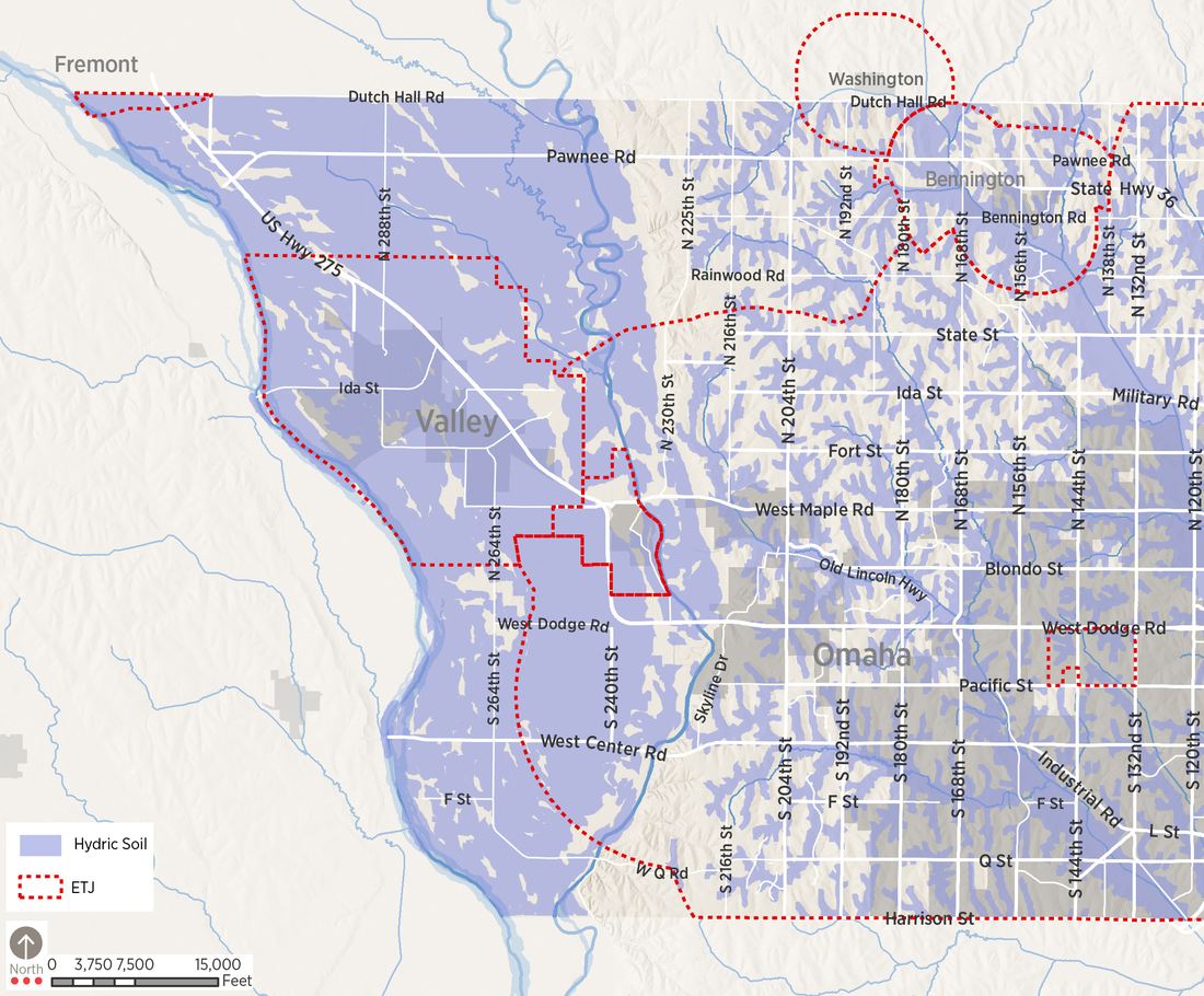
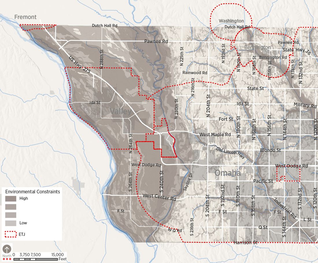
Map 2.6 WETLANDS
Infrastructure: Transportation Systems
As urban growth within Douglas County continues to move westward, its transportation system must also continue to grow. The County’s growth over the past twenty to thirty years has stressed the existing transportation system. Upgrades to the system have often followed development, placing traffic on a road system that is frequently unable to handle the increased loads. The upgrade of Highway 275 to an expressway and plans to continue to expand the section line roads east of 204th are significant initiatives that will increase the traffic capacity of major transportation corridors. This section will examine the County’s existing system.
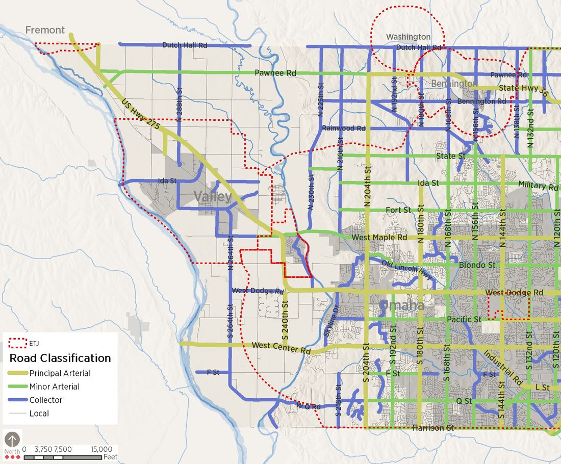
Map 2.9 illustrates the transportation resources of the County planning jurisdiction. Principal roads are classified as follows:
- State and Federal Highways. These principal arterials include:
- US Highway 275, extending from Omaha and Waterloo northwest to Fremont and continuing northward through the Elkhorn Valley. Since the completion of the 1998 Douglas County Comprehensive Plan, the highway has been expanded to a limited access 4-lane express and routed around Valley to the northeast. The former Highway 275 was renamed Reichmuth Road and is maintained by Douglas County outside of municipal boundaries.
- Nebraska Highway 92 (West Center Road), extending west across the Platte River to Wahoo.
- Nebraska Highway 36, a major east-west route between North Omaha and Fremont. Highway 36 carries substantial truck traffic as it provides primary access to the Douglas County landfill.
- Nebraska Highway 31 (204th Street), extending north and south from Gretna and Elkhorn to US Highway 30 near Arlington.
- Nebraska Highway 64, linking Valley with Highway 77 in Saunders County.
- Hard-surfaced Roads. These roads generally follow section lines and are paved to rural standards, generally in asphalt with grass shoulders. Some principal routes that break the section line grid include Military Road, extending to Elk City from 90th Street; West Q Road linking 264th Street with Q Street at 204th; 225th/230th Street from Maple to Highway 36; and Reichmuth Road from Valley to Fremont. Reichmuth Road includes paved shoulders that may be adapted for use in the planned Western Douglas County trail network.
- Gravel Roads. These County roads are generally found on section lines, although some diverge off the grid or use half-section line routes. These roads primarily provide agricultural access.
Street Classification
Map 2.9 illustrates the County’s existing federal classification system. Principal roads within the County are classified as follows:
Principal Arterials include State and Federal highways, and other major transportation corridors that provide regional access. Access to arterials is typically controlled, often limited to section and half-section points. Existing Principal Arterials within the Douglas County jurisdiction include:
- 204th Street/Highway 31
- West Center Road/Highway 92
- Pawnee Road/Highway 36
- Highway 275
Minor Arterials include State highways and other major transportation corridors that provide regional access. Access is less controlled than Principal Arterials but is often still limited to section and half-section points. Within Douglas County’s jurisdiction, only Highway 36 (Pawnee Road) west of 204th Street is classified as a Minor Arterial.
Collectors in Douglas County’s current classification system generally follow section lines and are hard surfaced. These roads are often two-lane rural roads and connect to the County’s arterial transportation system. Currently designated collector roads include:
- Military Road
- Dutch Hall Road/Bennington Road
- Rainwood Road
- West Dodge Road (east of 264th Street)
- F Street (west of 264th Street)
- West Q Road
- 192nd Street
- 204th (north of Pawnee Road)
- 216th Street
- 225th Street
- 264th Street
- 288th Street
Other County roads tend to be section-line roads that have a continuous north-south pattern but are disconnected by the Elkhorn River along east-west routes. As development pressures increase outside of Omaha’s jurisdiction boundary, these roads have experienced increased traffic volumes. The upgrade and maintenance of these roads is the responsibility of the County.
MAPA 2040 Long-Range Transportation Plan
The Metropolitan Area Planning Agency’s Long-Range Transportation Plan proposes significant regional improvements for the County - most of which are located within the Omaha jurisdiction. Within Douglas County’s planning jurisdiction, improvements include:
- The intersection of 204th and Pawnee Road
- 192nd South of Pawnee Road
Transit
Connecting individuals across the County with jobs in the western portions of the County is essential to economic vitality. Extensive improvements to Metro Area Transit’s (Metro) system in 2018 and 2019 including Omaha Rapid Bus Transit (ORBT) along the Dodge Street corridor, will improve capacity and visibility of transit. However, historic development patterns at lower densities, no sidewalks, and large parking areas separating sidewalks from front doors make it inefficient to serve with transit and very uncomfortable and even unsafe for users to access.
Future developments must be done in a way that includes all modes of transportation (transit, pedestrians, and bicyclist) at the beginning of the design process and not as an after thought. Offering safe routes for the first and last mile to the transit stop along with densities that can support transit will allow for continued expansion of services.
Infrastructure: Water and Sewer Systems
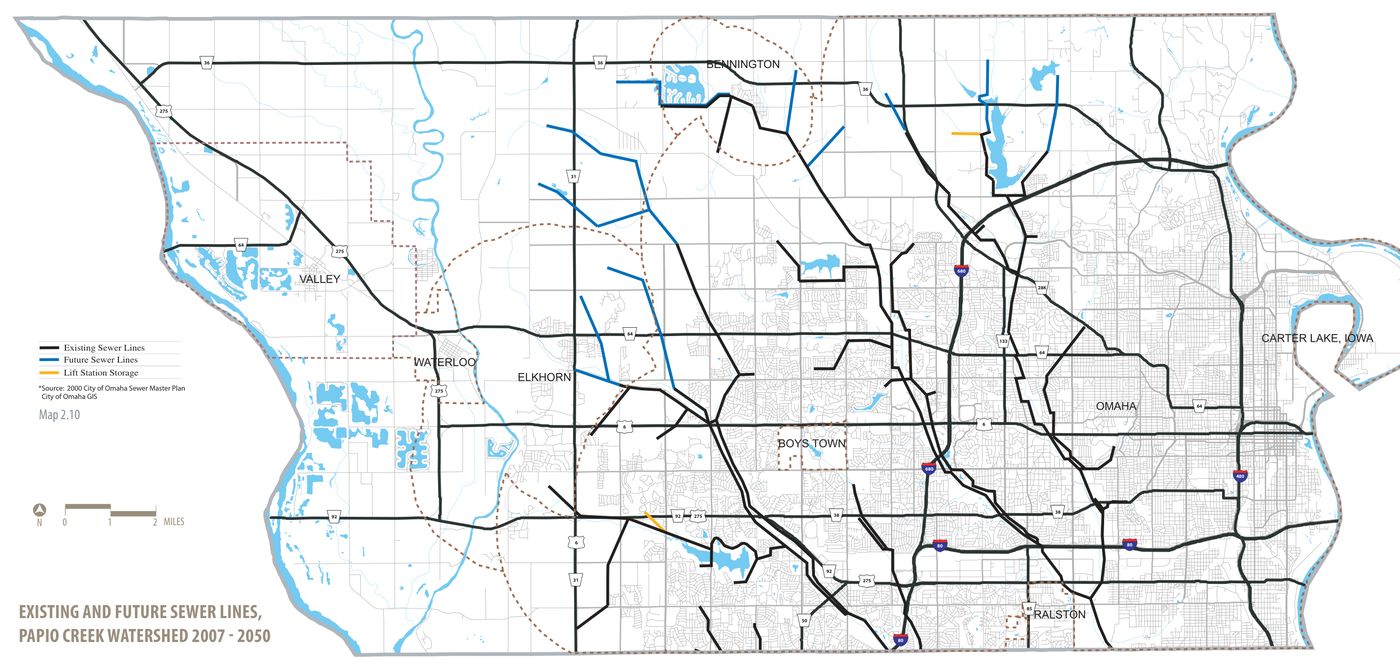
Within Douglas County there are three primary municipal wastewater treatment systems. The Omaha system is designed to serve the entire Papillion Creek Watershed, including areas in Sarpy County. The current interceptor sewer system is extended incrementally within areas Omaha has classified as its zone of present development. Developers contribute to the interceptor sewer fund which helps fund extensions of the system. The policy within the Papillion Creek watershed has allowed very limited pumping into the system from adjoining watersheds.
Waterloo also maintains a municipal sewer system. Valley took their local treatment facility offline and constructed a line roughly following Reichmuth Road tying into the Fremont wastewater treatment system.
Municipal water service in the area is primarily provided by the Metropolitan Utilities District (MUD) and the City of Valley. MUD’s well field around 264th and Q Streets was developed during the mid-2000’s. Water from these wells is pumped to a treatment facility at 204th and Q Streets.
The use of water resources and the interaction between groundwater and surface water is significant. As the 2006 plan was concluding, the Department of Natural
Resources was beginning to determine which basins, sub-basins, or river reaches were “fully appropriated” or “overappropriated.” As of 2017, the surface waters of Douglas County were not “overappropriated.” In 2017 the Papio-Missouri NRD completed the update of their Groundwater Management Plan. This plan’s objectives are: to describe the resources available, describe the current demands and contamination levels of the resources, and define the methods that the NRD will use to oversee the sustainable use of the groundwater resources. The plan noted that some areas have a higher density of domestic and irrigation wells and that well permitting and spacing requirements are recommended for these areas. The plan recommended the following policies and procedures for the protection of water users and existing well infrastructure.
- Require irrigated acre certification in the Integrated Management Plan (IMP) area. The IMP area affects land within the watershed of the Platte and Elkhorn Rivers
- Limit expansion of irrigated acres in the IMP area
- Require well permits for new wells that pump greater than 50 gpm
- Require minimum well spacing for new wells that pump more than 50 gpm (600 feet from registered domestic, irrigation, and industrial wells)
- Enforce irrigation runoff rules
- Require the installation of flow meters on all wells that pump more than 50 gpm by 2023
Water quality controls were also recommended in the Management Plan. These included:
- Encourage voluntary Wellhead Protection Area (WHPA) plans
- Offer both rural and urban fertilizers and irrigation management training
- Encourage chemigation by minimizing permit fee
- Voluntary well testing (“Test Your Well” events)
- NRD will specify commercial fertilizer application date restrictions
- Encourage annual groundwater nitrate testing, soil sampling root zone, and fertilizer application report through cost-share on lab analysis
- Offer cost-share for well abandonment, cover crops, and/ or selected BMPs
As of March 2018, many of these recommendations were included in the NRD’s Groundwater Rules and Regulations. These regulations are the final source and are periodically updated. Regulations now enforced in the Douglas County planning area include:
- No non-organic fertilizer application until after March 1 in the Platte and Elkhorn River valley