

This chapter addresses community service systems necessary to support the concepts and directions of the Land Use Plan.
Transportation Plan
As Omaha continues to grow to the west, the regional transportation system must also continue to develop. Rapid suburban growth has often strained the rural section line road system in areas adjacent to Omaha, and local governments have struggled to keep pace with demand. The County’s continued challenge will be to guide growth in ways that ensures an efficient expansion of the arterial and collector street system.
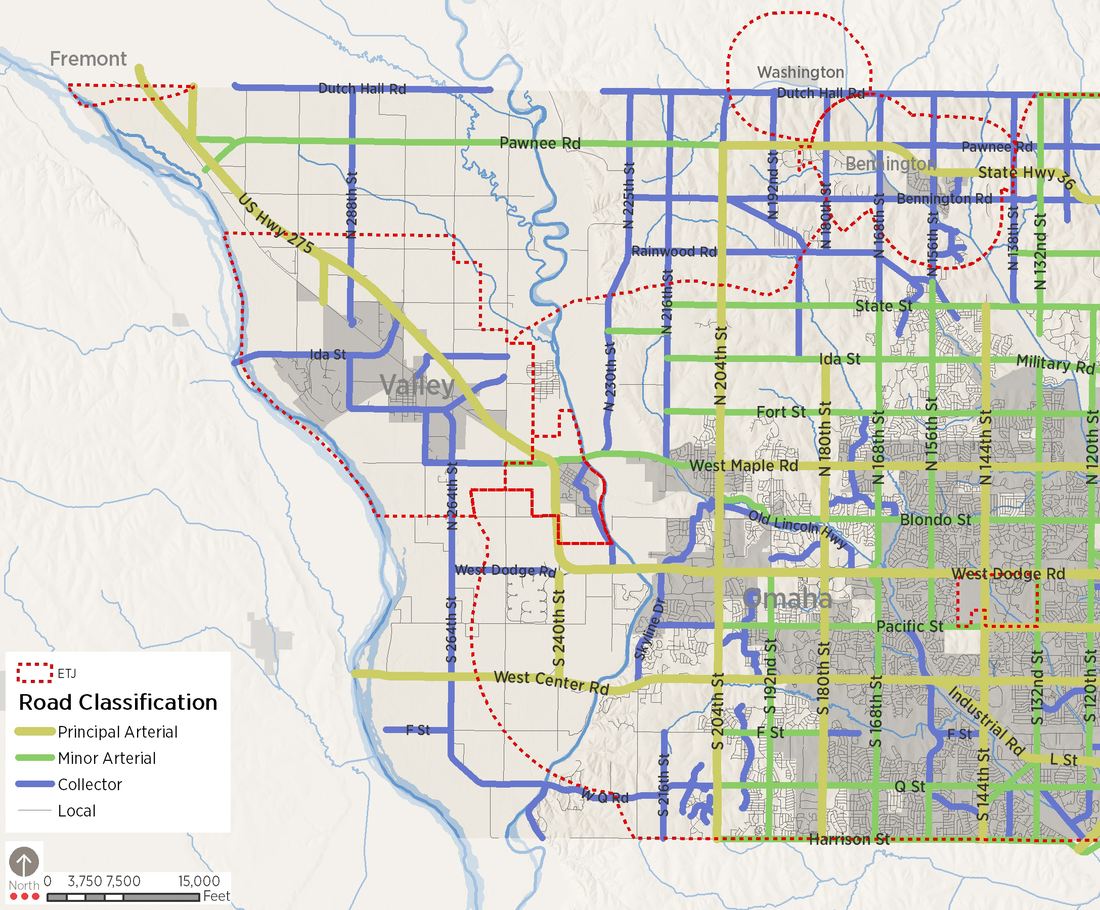
Map 6.1 displays the proposed transportation plan for the County, based on both regional needs and the future requirements of development proposed in the Land Use Plan. Elements of the Transportation Plan include:
Arterial System
The MAPA (Metropolitan Area Planning Agency) 2025 plan identified a number of section line arterial streets that needed to be upgraded in the coming years in Douglas County. The updated 2040 plan includes a few additional section line roads but most of these streets fall within the Omaha planning jurisdiction. Over the next twenty years growth that occurs in the Papillion Creek watershed should occur incrementally from existing development within Omaha and Bennington. Therefore, significant arterial improvements should not occur until after these areas are within the city’s planning jurisdiction. Timing of road improvements will be important, and densities that can support these improvements should be eminent. In addition to these improvements an arterial system will include section line roads in the Urban Development district and key cross County links west of the Elkhorn River. While much of this development will occur after these areas transition into Omaha or Bennington’s jurisdiction, any development proposals that come before the County should consider the need for these corridors and the appropriate timing of improvements.
The County’s system will include:
- US Highway 275
- West Center Road/Highway 92
- 204th Street/ Highway 31
- Pawnee Road/Highway 36
A Collector System
A network of collector streets should be established within any urbanized areas, typically on or near the half-section lines. They would be integrated into the neighborhood street system and provide neighborhoodto-neighborhood connectivity. They should be designed to relieve section-line arterials of the need to accommodate substantial local traffic. As such, the collector network improves local access, creates a better sense of connected community, and extends the effectiveness of the arterial system. Further, the land use patterns created by this fine-grained street network can bring local activity centers closer to home, reducing the length of typical trips. These half-section collectors should be dedicated incrementally with subdivision development. However, until that time the County should evaluate any proposed project with the eventual need for these corridors in mind. The policy of collectors on half-section lines is consistent with the City of Omaha’s comprehensive plan.
In the less urbanized western reaches of the County the collector street system will include some section line roads. These include:
- F Street
- West Dodge Road
- Rainwood Road
- Bennington Road
- Dutch Hall Road
- 216th Street
- 225th Street
- 264th Street
- 288th Street
Local Street Systems
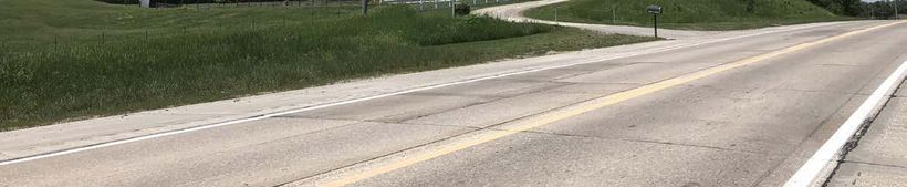
The County road system of the future will service a population accustomed to urban services and many areas will accommodate much higher densities than today. For this reason streets should be hard-surfaced. Paved streets should be required of all residential developments. Typically, urban standards will be used when densities exceed one unit per acre. However, the County should be open to innovative designs that use surface stormwater management and retention/detention, even in areas with higher densities. Local connections should also be provided between developments in additions to connections to the arterial and collector system.
Regional Planning
In 2014 MAPA published the Heartland 2050 Vision, a long-term regional vision. Goal 5 of the vision focused on infrastructure:
Together, our region’s investments will develop efficient infrastructure that supports economic development, provides more transportation choices, and reduces energy consumption. The outcomes for this goal included:
- 5.1: By 2050, we have a transportation system that allows for efficient movement of people, goods and services throughout the region by all modes. Land uses support walking, biking and transit. We have developed a human scale of infrastructure that can be accessed safely and comfortably with or without a car.
- 5.2: By 2050, we have high quality, efficient and affordable utility systems that foster health and prosperity and incorporate advanced technologies to better serve residents and businesses.
The first outcome notes the growing interest in a more diverse transportation system that can support individuals of all ages. While many individuals living in rural parts of Douglas County will remain car dependent, ways to provide more options to them and the workers that need to fill jobs in the region should be considered as a priority.
The infrastructure working groups formed since completion of the study identified six focus areas, including Multi- Modal Network with the goals of:
- Adopt a regional complete streets policy that addresses providing for all users and modes and considers the context of the land use when planning, improving and maintaining the region’s roadways. Monitor progress in achieving complete street goals, and celebrate successes throughout the region to encourage implementation of complete streets.
- Prepare model policies for local jurisdictions to adopt that provide for all users and modes in transportation projects. Prepare design guidlines for implementation throughout the region.
More recently, Heartland 2050 Executive Committee has focused on “Close the Gap” Plan which calls for creating vibrant places that are more livable and walkable, where people are better connected to jobs, education and other destinations through a robust regional transit network. Through this process high-capacity corridors have be identified to serve as “trunks” of a future system that would bring reliable and convenient transit service within reach of thousands more residents. This work also notes the need for concerted efforts of public, private, and philanthropic partnerships to develop the Close the Gap vision. The initiative noted that “average public transit spending per person in the Metro area was $36 in 2013, compared to $76 nationally.”
Transportation Funding
Funding both the back-log of improvements and meeting future needs of the regional transportation system is one of the most significant challenges facing the metropolitan region. In 2004, HDR completed a funding study for the Metropolitan Area Planning Agency (Transportation Funding Study Douglas and Sarpy Counties) that assessed the existing and future transportation systems in Sarpy and Douglas Counties, analyzed current funding mechanisms, and identified potential funding methods. The study found:
- An existing need of nearly $38 million in road improvements
- A future need for nearly $451 million in road improvements totaling $489 million in existing and future needs
- A gap for the entire study area (Douglas and Sarpy counties) between baseline revenue and needs that will total roughly $30 million per year with annual increases resulting in a $42 million per year gap by 2025
The study identified potential revenue sources for filling this gap. These included:
- Developer contributions
- Local options sales tax
- Occupation head tax
- Property taxes
- Nebraska State Highway Allocation Fund
- Elimination of street lighting expenditures
The City of Omaha and Douglas County began to address this issue with the approval of the Arterial Street Improvement Program (ASIP Fund) in 2005. The program is designed to fund the design and construction of arterial street improvements.
Trail and Pathway Network
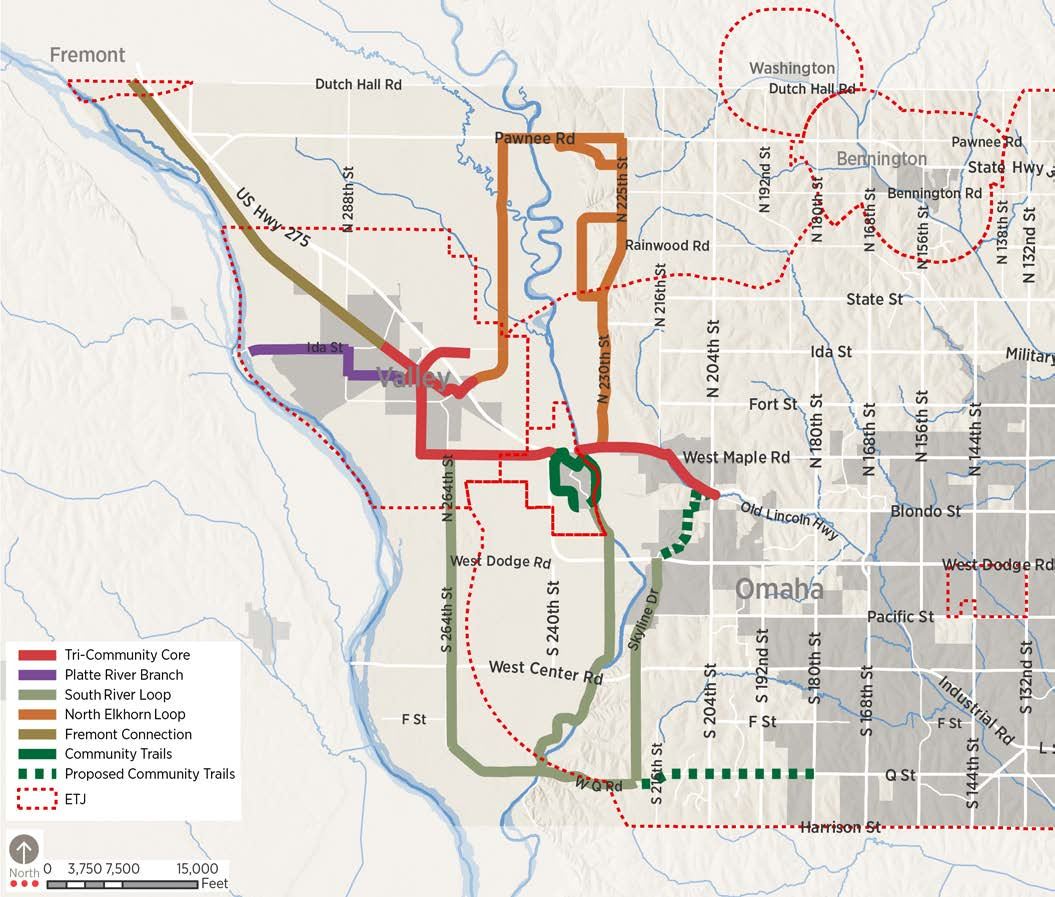
Non-motorized transportation should be incorporated into the County’s overall transportation framework, providing alternatives for short and medium-distance trips. In an effort to identify ways to expand the regional trail system to areas outside Omaha and the Papillion Creek system the Western Douglas County Trails Plan was completed in 2004. The basic trail framework is identified in Map 6.2.
The system is based on six trail types. These include:
- Exclusive off-road trails. These trails are physically separated from motor vehicle traffic and rights-of-way and are typically built along utility, railroad, or drainage corridors, or within a greenway acquired by purchase or easement across private land.
- Separated roadside trails. This class of trail resembles off-road trails, except that they are developed on or adjacent to road rights-of-way.
- Paved shoulders.
- Detachable shoulders. This technique applies to bicycle shoulder segments where the drainage ditch either disappears or is set back far enough from the driving surface to permit a separated roadside trial.
- Share the Road (STR) Routes. These routes are suggested (but not mandatory) pathways for bicyclists from one place to another. These streets generally do not require major capital improvements other than assuring their accessibility and ease of safe use to cyclists.
- Walking Trails. Walking trails vary from paved surfaces to more natural surfaces such as wood chips. They are most applicable in the hilly and natural areas, where the casual user will not expect full accessibility to people with disabilities or wheeled vehicles.
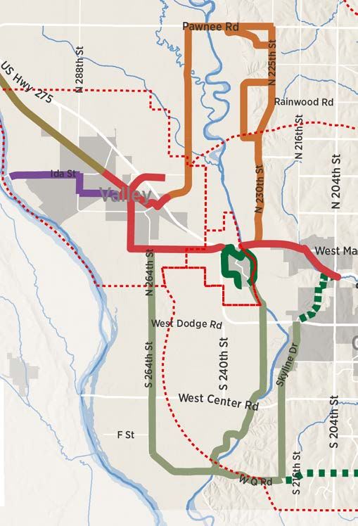
The plan concept laid out in the Western Douglas County Trails Plan includes the following major features:
- A Tri-Community Core that connects Valley, Waterloo, and Elkhorn with each other and with the metropolitan trail system.
- A Platte River Branch that connects Platte River Landing and Ginger Cove to Valley and the Tri-Community Core. This branch uses road segments and is integrated into a city trail for Valley.
- A North Elkhorn Loop that utilizes road rights-of-way that ring the Elkhorn River, and connects to the Elkhorn River at specific public access points. This loop is integrated into the Elkhorn River Canoe Trail at these access nodes. The legs of the North Elkhorn Loop are connected into the Tri-Community Core and tie together through Waterloo.
- A South River Loop, mirroring the North Elkhorn Loop by using roads that parallel the Elkhorn and Platte Rivers. The South River Loop forms a ring around the Elkhorn River in concert with Omaha’s proposed Skyline Trail. The loop also provides a direct connection to Two Rivers State Recreation Area and serves major population centers like Westshores and Riverside Lakes.
- The Fremont Connection, using the Reichmuth Bikeway to connect Douglas County into Fremont and its evolving trail system.
- Connections of both major river loops into the Omaha metropolitan trail system at their north and south edges, and linkage of the Tri-Community Core into the central part of the Omaha system.
Infrastructure
Wastewater
Wastewater and stormwater management will be significant issues as the County develops at higher densities. In the past, wastewater treatment has been handled either through septic systems or community wastewater systems. However, major development in the Bennington vicinity have extended Omaha’s sewer system and consequent urban development far earlier than anticipated by the 1998 Douglas County Comprehensive Plan. Sanitary sewer service should be provided in the entire northern section of the Urban Residential District during the planning period. These extensions, like other extensions in the Omaha jurisdiction, are likely to be funded by the City of Omaha’s Interceptor Sewer Fund. Therefore, all new subdivisions in this district must be designed at urban densities and be connected to municipal sewer.
The County’s largest subdivisions are in the southern part of the jurisdiction and some are connected to municipal wastewater systems. Westshores pumps its wastewater to Waterloo. The Hamptons, South Hamptons, and Forest Glen pump wastewater east over the ridge line to the Omaha system. In recent years, wastewater handling for new developments in this area has been addressed on a case-by-case basis by the City of Omaha. These connections will remain at the discretion of the city and its assessed ability to handle the additional waste.
Wastewater Policies
Urban Residential Districts
In the Urban Residential District, all new subdivision development will be served by municipal services, including sanitary sewer. Interceptor sewers will be developed incrementally from the current terminus of the line and will typically be financed by the City of Omaha’s Interceptor Sewer Fund. Acreage developments under 80 acres per unit on individual systems should not be permitted within this development district.
Existing developments built out to urban densities should connect to municipal sewers when they are extended into the area.
Development Reserve District
Densities in the area will remain very low, with a recommended minimum density of 80 acres per unit. Lot sizes may only decrease if permission is granted to pump wastewater into the Papio system.
Resource Extraction District
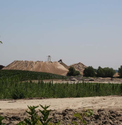
Development in these areas currently use individual or community wastewater systems. The long-term population potential of these areas may exceed the ability of these systems to provide adequate service and protect water quality.
All new developments on former resource extraction sites should be on central sewer and water systems.
Water Systems
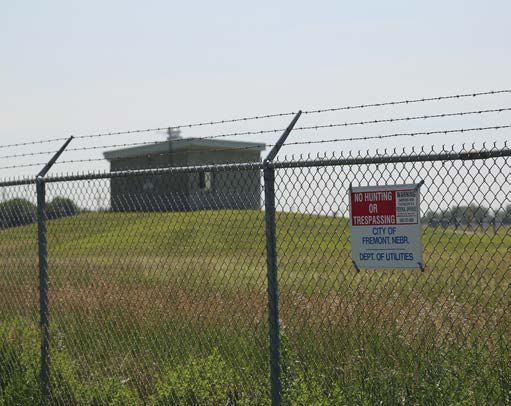
New subdivisions developed at urban densities must utilize municipal water systems. Within the urban growth areas municipal water will be extended with the sewer system. A large Metropolitan Utilities District (MUD) wellfield operates in the southwestern corner of the County, generally southwest of 264th and Q. Water from this wellfield is pumped east along Q Street to a treatment plant at 216th Street. Municipal water can be provided to this area with the construction of a distribution line west of the treatment plant.
Existing and future residential projects in the Resource Extraction Area should utilize the Valley or Waterloo systems for water supply. Waterloo currently works with MUD for its water supply and provides service to the Westshores subdivision.
Stormwater Management
Since completion of the 1998 Douglas County Comprehensive Plan, pressure to improve stormwater management and water quality has increased. New federal mandates impose water quality standards on urban runoff. This places a greater emphasis on site-related stormwater management, designed to reduce the volume and velocity of runoff and provide for on-site absorption of stormwater. These techniques can be used to create “greener” developments that will also help to satisfy the desire of existing County residents for maintenance of rural character.
To address these issues on varying scales from individual lots to the entire County, Stormwater Best Management Practices have been established. The practices use a “distributed stormwater management” approach rather than the more conventional “end of the pipe” approach. The approaches are laid out in Appendix B and are divided into two sections. The first section describes stormwater best management practices (BMPs) in various categories, including policy/regulations, planning/zoning, stormwater management, and landscaping. The second section illustrates conservation site design templates for various types of developments that may be applied throughout Douglas County.
The BMP techniques identify strategies and guidelines for stormwater management and water quality protection, including ecologically and hydrologically sensitive designs that can be included in an overall watershed protection and management program. The stormwater BMPs are also multi-dimensional practices that can meet traditional water quality and quantity control standards outlined in many stormwater ordinances, as well as achieving planning, urban design, and landscaping objectives.
The templates identified in the second section of Appendix B are more specific and apply to the site level application of BMPs. Seven templates are laid out for commercial/industrial sites; moderate density residential, rural residential, and estate residential sites; agricultural areas; stream corridors; bluff and ravines; and lakes and wetlands. Each of these templates is designed to illustrate conservation-based development and land management techniques and to contrast those techniques to the typical developments Douglas County has seen in the past. The basic concept of these templates should be transferable to most development plans, with modification for site conditions and land characteristics.
Public Facilities
Public facilities include public buildings and community services which are necessary to support development in the County’s planning jurisdiction. These facilities include schools, public safety facilities, and parks and open spaces.
Schools
There are seven school districts serving the Douglas County jurisdiction with school facilities located within constituent communities. The districts include:
- Bennington Public Schools
- Elkhorn Public Schools
- Arlington Schools (based in Washington County)
- Fremont Schools (based in Dodge County)
- Douglas County West Public Schools
- Gretna Public Schools (based in Sarpy County)
- Millard Public Schools
Beginning in the 2005 school year, Valley and Waterloo school districts consolidated forming Douglas County West (DC West). Elkhorn and Millard public schools have continued to expand with the opening of new elementary schools and plans for a high school in the Elkhorn district.
The plan projects near-term development to be focused in the northeast sectors of the jurisdiction in the Bennington and Elkhorn school districts.
Public Safety Facilities
The Douglas County Sheriff’s Office provides police services throughout the jurisdiction and outside the municipal limits of communities. The sheriff’s base of operations is the law enforcement center at 156th and West Maple Road. The facility opened in 1997 and provides good access throughout the service area.
Fire protection services are provided through rural volunteer departments, housed jointly at fire stations in individual communities. These districts, complemented by mutual assistance agreements, provide generally adequate coverage to the County jurisdiction. A chronic limiting factor has been the availability of adequate water storage. As urban level development should occur adjacent to existing development the water sources needed for fire protection should exist.
Parks and Recreation
Parks and recreation concepts have been discussed in the context of the land use plan. In addition to municipal parks within constituent towns, the jurisdiction’s main public recreation facility is Two Rivers State Recreation Area.
Major park, open space, and recreation recommendations include:
- Incorporating park land and open space by applying conservation subdivision concepts. The preservation of a substantial part of a subdivided parcel in common or open space will provide adequate reservations of open space for recreation purposes. Each subdivision’s open space should be open ended and connected to open spaces in adjacent developments.
- Omaha’s Suburban Parks Master Plan should be extended to future Urban Residential Districts. Providing designated neighborhood and community parks ensures a level of service residents within Douglas County’s communities have come to expect.
Solid Waste Disposal
The existing landfill is meeting the County’s needs; however, an element of long-term County and metropolitan planning should include measures to reduce the overall waste stream making more efficient use of existing resources. Therefore, techniques such as:
- Education efforts that identify ways to reduce the amount of waste generated so that it does not have to be “managed” in the first place.
- Recycling and reuse efforts, including composting, so that resources in the waste stream are utilized to the maximum extent practicable. The emphasis should be placed on development of local markets for resources diverted from the landfill. Local business expansion is essential to support and offset the loss of revenue to the landfill.
- Landfilling what cannot be recycled or reused from the waste stream.