

This chapter outlines the Land Use Plan for Douglas County, based on the preceding chapters in this plan.
Policy Influences
Determining appropriate land use policies includes an interaction of several factors:
- First Principles. Chapter Four presented the First Principles guiding development of the Douglas County planning jurisdiction. These Principles provide the basic statements and assumptions that underlay land use policy. They provide the foundation for development that meets the future growth demands without compromising environmental qualities.
- Existing land use patterns and current demands. These factors establish the facts on the ground that the land use plan should accommodate. While the plan will direct the market to some degree, a realistic plan must take into consideration market directions and what is best for the environmental, economic, and civic health of the County.
- Environmental Constraints. The previous chapter identified those environmental features that should be preserved or valued in determining the future development pattern of the County. The First Principles established environmental constraints as a significant determinant of County development policy. In summary, those areas that are less environmentally constrained can sustain higher development densities while those that are more constrained or have important environmental value should be preserved or have minimal development.
- Feasibility of urban services. The ability to provide sewer and water services is a fundamental imperative of development policy in Douglas County. Specifically, those areas that fall within feasible urban services areas can be dedicated to providing urban density development. The mandatory use of conservation standards and best design practices can create distinctive projects rather than conventional subdivisions, conserve natural resources, and provide opportunities within the designated open spaces for progressive stormwater management.
- Stormwater management. This is one of the key components identified within the First Principles. Stormwater management techniques are also closely tied to many of the other First Principles, such as:
- Protecting and stewarding the environment and natural resources. Preserving and restoring remnant natural communities often decreases run-off volume and rate.
- Preserving and enhancing the unique character of the County. A component in preserving the rural character of the County will be the preservation of the County’s drainageways, including buffer areas around these drainageways that can facilitate the absorption of stormwater runoff, mitigate flooding, reduce stream degradation and improve water quality.
- Preserving and protecting floodplain areas. Floodplain development will increase runoff rates and negatively impact the floodplain area and depth. Emphasis should be on maintaining floodplains and floodplain function and reestablishing floodplain function in areas where it has been lost.
- Implementation of conservation development techniques. Conservation development techniques and effective stormwater management techniques often work together. Conservation developments require protection of open space, stream corridors, and environmental resources. All of these can be implementation tools in any stormwater management plan.
- Reservation of a specific percentage of open space and incorporation of open space, streams, and trails into residential developments. Development of green infrastructure will minimize negative environmental and aesthetic impacts, provide recreational benefits, and will be part of the overall stormwater system.
- Multi-modal, green-street transportation system. This is a road system that includes landscaping and buffering, which can also assist in conveyance of stormwater and decrease the amount of runoff channeled to a curb and gutter system.
- Utilization of conservation easements. Conservation easements can facilitate protection of the natural environment and native stormwater systems.
Stormwater management policies and techniques are discussed in further detail in Chapter 6 and Appendix B of this document.
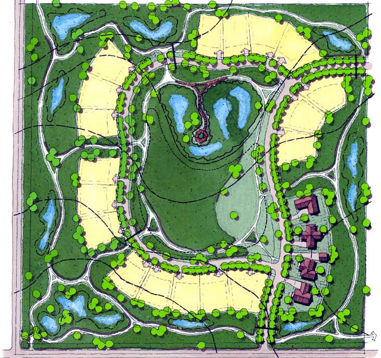
Example conservation subdivision (see Appendix B)
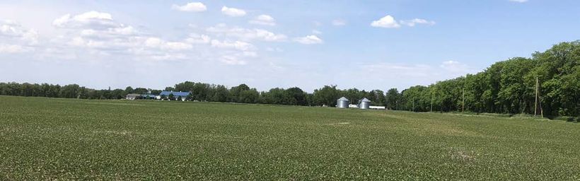
Land Use Policy Process
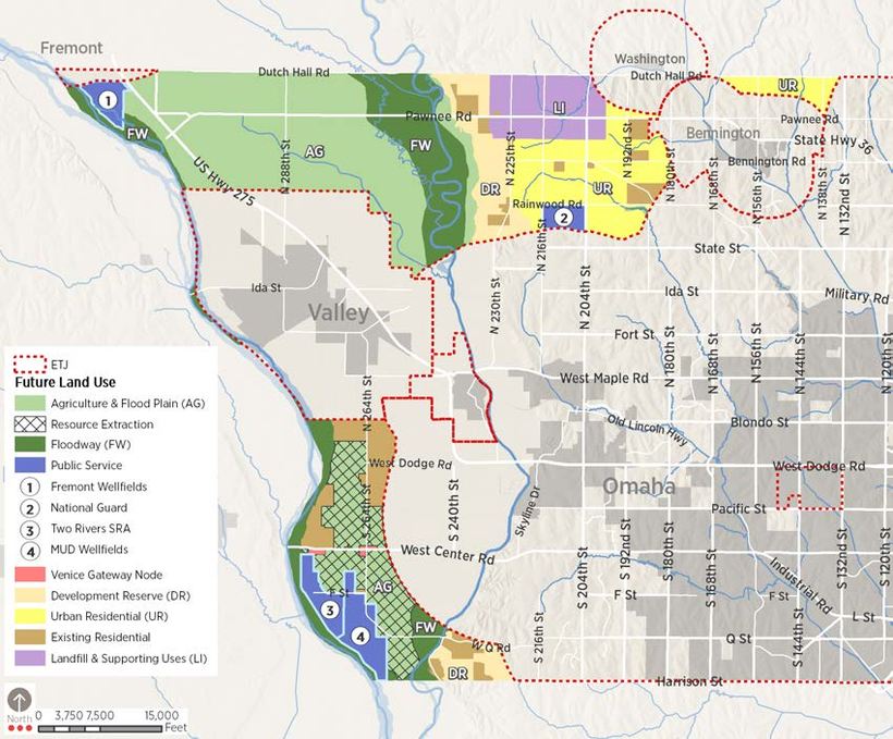
Planning does not end with the publication of this plan. Instead, the Comprehensive Plan must establish a process that guides hundreds of small decisions over time that will determine the direction of County development. This section presents a vision of how the County should develop over time based on the above policy influences. The following discussion presents the basic principles for each Development Area identified by the Future Land Use Plan (Map 5.1). These principles should be used to help guide private and public development decisions and policies within each Area.
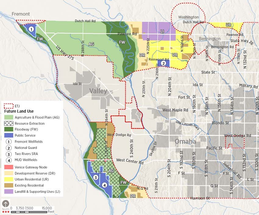
Development Areas
The Future Land Use Plan identifies the following Development Areas, with policies based on location, markets, environmental considerations, and urban infrastructure issues:
- Existing Residential
- Urban Residential
- Floodway
- Agriculture & Flood Plain
- Resource Extraction
- Development Reserve
- Landfill and Supporting Uses
- Venice Gateway Node
- Public Service
Each policy area is detailed in four ways:
- An Introduction, summarizing the major ideas, themes, or intent of the policy areas.
- A Geographical Descriptor, describing the attributes that make this area distinctive.
- Guiding Factors for making policy decisions.
- Principles and Patterns that should be applied to each area.
Existing Residential
Introduction
The County’s existing jurisdiction offers a variety of residential developments.
Geographical Descriptor
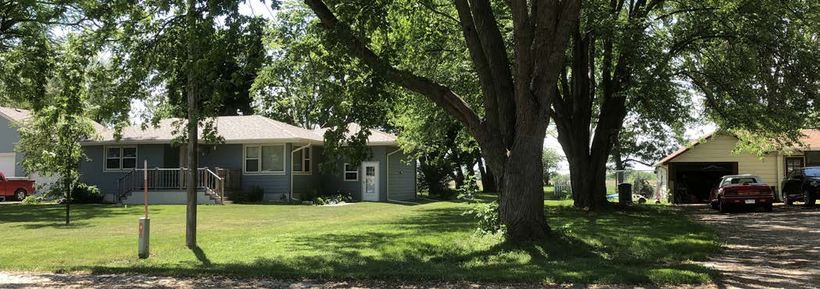
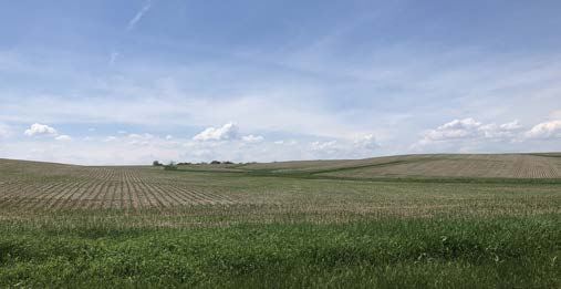
Existing residential development is scattered throughout the County and includes farmsteads that have been occupied for generations, newer developments such as the South Hamptons and Forest Glen, older County subdivisions such as Fawn Heights that use individual wastewater systems but are developed to relatively high densities, and lake-front homes between the Elkhorn and Platte Rivers. Policy changes adopted in the 2006 Plan require new development to locate adjacent to areas already served by municipal services and to hook up to those services.
Guiding Factors
Many of these areas are previously platted subdivisions. The density of future residential development depends on current development patterns, previous plats, and the policies appropriate to their corresponding policy areas. Many existing residents value the rural lifestyle of western Douglas County and are concerned about higher density development. However, if the previously platted subdivision is within the area that can be served by the Papio interceptor sewer system, then that takes precedence over the preservation of current development densities. Furthermore, once municipal water and sewer services are proximate to existing platted development those developments should then connect to those services. Replatting, to increase densities of existing low density subdivisions should be encouraged.
Principles and Patterns
- New residential development should incorporate the rural aspects of the County through preservation of open space and protection of drainageways and other natural features, including wetlands and native prairie sites. If replats occur, conservation techniques should be utilized with mandatory implementation within environmental resource areas. Extensions of existing lake front developments should also implement techniques such as lot clustering, open space requirements, and wetland protection. For lake developments, these approaches should also protect water quality and water habitat.
- Small-lot subdivisions on individual systems, such as Fawn Heights, that will eventually be within the urban services area should connect to municipal sewer and water when it becomes available.
- When possible, existing subdivision plats that are requesting replats should be modified to take advantage of contemporary best practices for stormwater management and to maximize compliance with other principles for residential development.
Urban Residential
Introduction
Urban development using municipal services will continue to be a strong market within the County. This demand should be accommodated within urban service areas while ensuring the preservation of environmental and aesthetic qualities.
Geographical Descriptor
The Urban Residential areas are outside of the existing extra-territorial jurisdictions of Omaha and Bennington. The area encompasses approximately 2,766 acres and is characterized by rolling hills and smaller drainageways that flow into the West Branch of Papillion Creek. This places them within urban service areas, sewerable by gravity flow in the Papillion Creek basin. Agricultural and open space uses dominate in the area but are often transitional pending future development. This development area also encompasses or surrounds existing developments or residential clusters, including subdivisions such as Shiloh Ranches and Fawn Heights.
Guiding Factors
- Adjacent to the urban service areas of Omaha and Bennington, the area can easily connect to the sewer system of the Papillion Creek Watershed. As a result, it should be devoted to urban density development connecting to municipal wastewater services. Developments should also include sidewalks and other pedestrian features that support transit services.
- Development in the Urban Residential area should combine urban density with protection of open land character and scenic and environmental values through the required use of conservation development standards. These techniques include lot clustering and preservation of environmental resources.
Principles and Patterns
Development Densities
- Development within the future urban residential areas should be at medium or higher densities, typically in the range of six to 12 units per acre. Other uses must be done at a scale and density that supports walking, biking, and transit to an equal level of the car (see urban form below). Conservation subdivision techniques will be required, and regulations should allow for density bonuses when additional lands are protected or placed in open space.
Urban Form
- The overall design pattern in the area should maintain drainageways as open space with primary development on the upland areas. As development occurs, these open spaces should naturally connect for the purposes of better stormwater management and interconnected open space corridors. To the maximum degree possible, storm drainage should be handled on the surface, mitigated to the maximum extent possible where the precipitation falls and then conveyed to open areas, thus decreasing both volume and velocity of stormwater reaching streams.
- Roadways should generally be designed to follow contours, including road alignments on ridgelines to maximize views and permit natural stormwater management along the drainageways. Roads should include sidewalks or sidepaths that connect residents to services and jobs and make transit a viable option.
- New developments will preserve other environmental features using conservation design techniques. Environmental features will be identified through a natural resources assessment. Under conservation regulations, the underlying zoning establishes the yield on the property; smaller lot sizes are permitted and encouraged in return for the conservation of natural resources and significant open spaces beyond the minimum requirements. Clustering of development to further support interconnected open spaces, better stormwater management, or opportunities to capitalize on local food production or renewable energy should be encouraged, potentially through density bonuses. Conserved open space may be used for stormwater management, limited local food production/urban agriculture, renewable energy generation, and/or recreational uses. As a policy, these preserves should be open-ended, providing opportunities for connections to preserves in adjacent developments.
Transportation Network
- Development of a continuous transportation network is necessary to support the demands of urban density development. The district should have a continuous transportation grid on top of the existing section line roads with collectors generally on the half section line, consistent with current City of Omaha requirements.
- The system should follow the landforms, decreasing stormwater run-off rates and the number of bridges. Within subdivisions, connections should be made to adjacent developments, linking neighborhoods and avoiding isolated enclaves.
- The overall transportation system should provide for pedestrian, bicycle and transit, as well as single-person vehicular access. Internal greenways and trails should be interconnected and should consider the systems identified by the Metropolitan Omaha Trail Plan and the Western Douglas County Trails Plan.
- Development of a continuous transportation network, sidewalks, trails, and designated bike routes should support transit along designated routes.
Floodway
Introduction
Floodways have been designated by FEMA as the highest risk for flooding, and therefore development is prohibited in these areas.
Geographical Descriptor
The Floodway areas include the Elkhorn and Platte River floodways. The Floodway area around the Elkhorn on the north is equally divided by the river south of Bennington Road. To the north, the river has meandered to the east and hugs the bluffs north of Highway 36. The Platte River floodway is much narrower as the actual river channel is much wider than the Elkhorn. The Floodway widens out south of Highway 92 (West Center Road) as it eventually merges with the Elkhorn Floodway.
Guiding Factors
Development within the floodway will continue to be prohibited per FEMA requirements. Some areas may contain sand and gravel resources which can be mined with the area remaining undeveloped. Buffering of drainageways should improve stormwater management and ultimately sustain or improve the overall water quality of the rivers and their tributaries.
Principles and Patterns
The Floodway areas may be used for local food production/ urban agriculture and recreational purposes like Two Rivers State Park or river access points, provided that this use does not cause the loss of natural resources such as wetlands or increase the flood risk. Open space corridors may be held privately, cooperatively by residents’ associations, by nonprofit organizations such as camps and land trusts, or by public agencies. The requirement for conservation of drainageways should ultimately create an interlinked system of open spaces that, long-term, connects to the Elkhorn and Platte Floodway areas. The combination of open spaces along drainage corridors and the Floodway areas should create an interconnected system for man and nature by preserving wildlife habitats and corridors.
Major open space corridors and Floodways include:
- Although it is not illustrated on the map, an open space network will ultimately emerge with the protection of drainage corridors required by the conservation development standards. This network will incorporate the drainage corridors, wetlands, prairie preserves, and native forested areas. It should provide a web of local trails that connect to the regional trails and greenway system of the Papillion Creek watershed and the network laid out in the Western Douglas County Trails Plan. Open space corridors may include a variety of uses and should include space to provide for local food production, and potentially renewable energy.
- Within these river Floodways, the public policy should encourage the donation of easements to public or nonprofit agencies to conserve the waterways of the Elkhorn and Platte rivers.
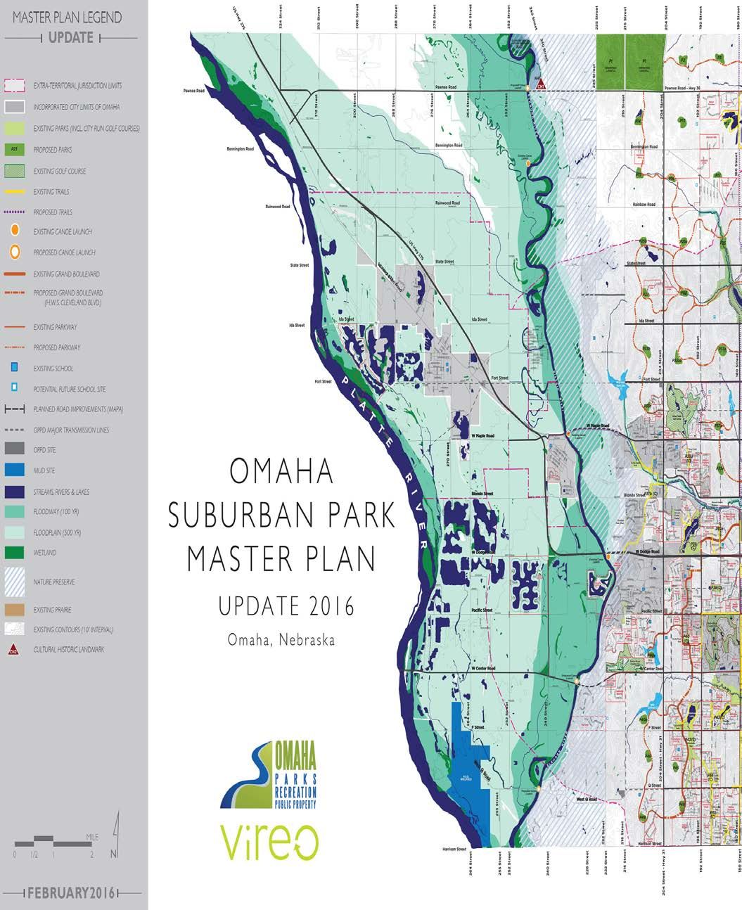
- When possible, these open spaces should add to the overall recreation system offered by the NRD and other local jurisdictions or support the implementation of the Omaha Suburban Parks Master Plan.
Recreational opportunities in the Floodway area may include, but not be limited to, camping, river access, nature study, passive recreation, and trail development.
Agriculture and Floodplain
Introduction
The Elkhorn and Platte River floodplains feature rich agricultural areas and vital flood storage. Land use policy should maintain these areas as open space and encourage local food production/urban agriculture.
Geographical Descriptor
The separate Platte and Elkhorn River floodplains stretch across the western edge of the County. On the north side of the County, these broad, flat plains are primarily in row crop production, dotted with residential farmsteads. In addition to the agricultural use projection, the southern portion of the floodplains includes several resource extraction operations and lake-oriented residential developments.
Guiding Factors
The First Principles call for development to be limited and avoid enlarging the floodplain or endangering property. Large-scale developments elevated out of the floodplain can increase the reach of flood waters. Therefore, the appropriate final land use in most of the Floodplain Area is agriculture, with local food production and urban agriculture-related uses encouraged. Residential development in these plains, outside of lake-related developments, should be prohibited or limited to farmstead lot splits of existing homes.
Resource Extraction Area
Sand and gravel resources are essential to the building industry, and their proximity to the metropolitan area lowers transportation costs of the materials to building sites. Protection of these resource extraction sites is economically important to the larger region. When mining is completed on a site, however, it can transition to other uses including low-impact recreation or habitat preservation areas. Any lake-oriented residential development should connect to central water and sewer systems. Developments will have to demonstrate limited intrusion into the floodplain and the negative effects of floodplain development.
Principles and Patterns
Floodplain areas can still be developed once they are elevated; however, elevation can affect adjacent property owners. The primary use in these areas will be agriculture, with an emphasis on local food production.
Residential development densities should not exceed one unit per 80 acres, with the option to do some agricultural clusters that preserve large parcels of land for agricultural production and maintain a very low overall residential density.
Resource Extraction Areas
- Residential Development Densities. Upon completion of mining, extraction sites outside of the floodway and their remaining lakes have the potential to be developed as residential communities.
All developments will require municipal water and sewer services. A very high water table exists throughout the area, increasing the chances of contamination from poorly-maintained septic and community wastewater systems; therefore, future septic tanks should be prohibited in this area. Water supply for residential developments, including both domestic and residential irrigation uses, should follow the recommendations and requirements of the Papio-Missouri River NRD’s Groundwater Management Plan. In that plan, the NRD can restrict any new high-capacity wells (greater than 50 gpm) and all wells should not be located within 600 feet of an existing high-capacity well. Additionally, any new well should be placed toward the bottom of the available aquifer to prevent water availability issues for smaller wells and for greater protection from contamination.
In previous lake-oriented developments in Douglas County, the lake accounts for about 38 to 48% of the entire development area, and the project provides one unit per 120 to 140 feet of shoreline. These assumptions produce a typical gross density of about 2.5 acres per unit. Developments should implement the Best Management Practices identified in Appendix B to control stormwater runoff into the lakes and overall water quality. Higher densities may be considered with the implementation of strict controls on stormwater runoff.
- Development Form. Ideally, preliminary design of lake developments would be considered prior to mining operations, making it easier to incorporate open space, wetlands, and habitat development areas. Open space and wetlands should be planned to serve as green connections between other lake developments. These areas would also maintain the integrity of the landscape and could improve stormwater management within the area.
Within the design of each lake development, the Best Management Practices (BMPs) should be implemented to decrease stormwater runoff volume and rate. The Platte River has both a surface level and subsurface level flow that moves north to south and through individual lakes. The BMPs should assist in protecting the water quality of individual lakes but also on a broader regional level. These techniques include wetland management and restoration, riparian buffers, bioswales, rain gardens, vegetated swales, and native landscaping. Descriptions of these techniques and others are available in Appendix B.

Development Reserve Area
Introduction
Over the years there has been interest in the development of the Elkhorn Valley bluffs. The Development Reserve area identifies those areas that are outside the Papio watershed and require special permission to connect to the Papio wastewater system.
Geographical Descriptor
The Development Reserve area is defined on the east by the ridgeline that separates the Papio Creek and Elkhorn River watersheds and on the west by the Elkhorn River floodplain and floodway. The area tends to have steep slopes with excellent views of the Elkhorn River. Over the years trees have grown along these bluffs, overtaking the native prairie grasses. The excellent views and rural nature of the area has attracted residential development. However, since the area is located outside the Papio watershed, it is technically outside the metro region’s wastewater system.
Guiding Factors
This area has some of the steepest slopes in western Douglas County, as well as some of its most scenic settings. The district’s location inside the Elkhorn River watershed makes an extension of municipal services to this area difficult. As a result, the most appropriate land use for this district is to remain as open space or used for limited local food production/urban agriculture.
Principles and Patterns
The development reserve area will remain primarily in open space or local agricultural use for the foreseeable future. Densities in the area will remain very low, with a recommended minimum density of 80 acres per unit. Lot sizes could only decrease if permission is granted to pump wastewater into the Papio system, and access to regional water service is feasible. For the foreseeable future, local agriculture production should be encouraged. For areas with steeper slopes, restoration of native habitats or innovative farming practices should prevent further erosion.
Venice Area
Venice Gateway Node
Introduction
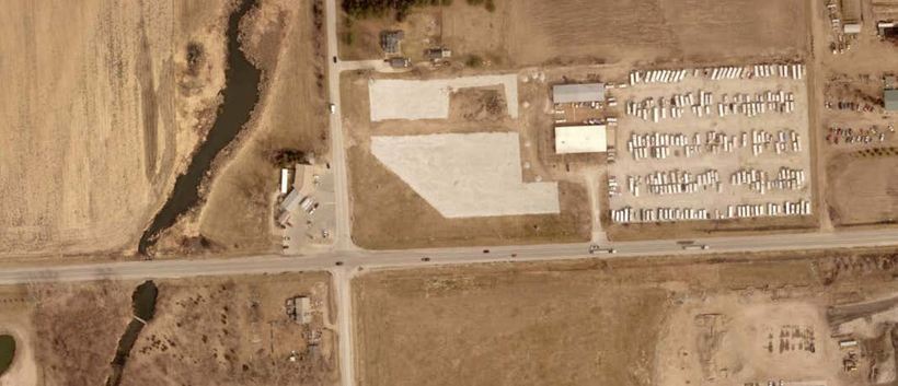
The Venice Gateway Node is an existing commercial area that is one of only two western entrances into the County for many travelers. Due to lack of infrastructure services to the area, it will not expand, but redevelopment of existing uses should welcome visitors to the County and create a positive first impression.
Geographical Descriptor
Existing commercial uses located around the Venice area at Highway 92 (West Center Road) and 264th Street.
Guiding Factors
Located at a major intersection, Venice should function as a gateway into the County and Two Rivers State Park, offering neighborhood commercial services. Expansion beyond the existing footprint is prohibited unless full municipal services, including water, sewer, and adequate transportation services are provided. “Adequate transportation services” include, but are not limited to, acceleration and deceleration lanes, left turn lanes, and a fully signalized intersection at 264th and West Center Road. Additionally, its location within the floodplain should limit expansion. As a gateway, specific design standards should be established for when the area redevelops. These standards could include use types, overall scale of development, site amenities, parking standards, and building materials.
Principles and Patterns
- Redevelopment of the Venice area should add landscaping and improved on-site stormwater management. Any future redevelopment should also take into consideration any potential widening or improvements to West Center Road. These improvements may include turn lanes or service roads.
- As a highly visible intersection with increasing traffic volumes, development should follow design guidelines that address materials, site planning issues, landscaping, building scale, signage, and site amenities. Projects should employ best stormwater management practices, including such techniques as bioswales, green roofs, naturalized detention and infiltration trenches, rain gardens, vegetated swales, and native landscaping.
Landfill and Supporting Uses
Introduction
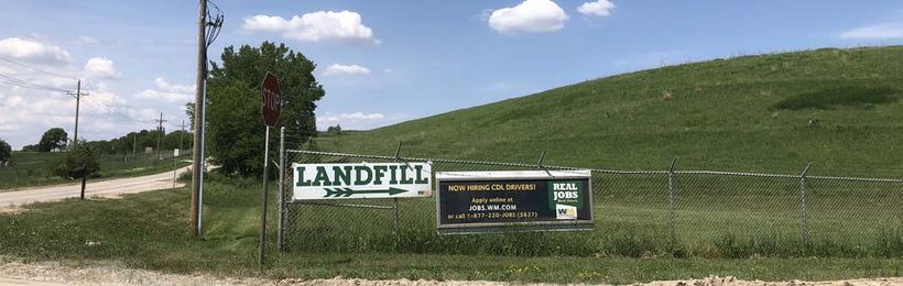
The landfill and surrounding area should support commercial, business park, and light industrial uses with priority given to solid waste recovery and reuse, allowing for the use of local resources and local resource market development to the greatest degree possible.
Geographical Descriptor
The Landfill and Supporting Uses area includes the Pheasant Point Landfill and an area approximately a half mile around the present and former landfill.
Guiding Factors
The area should continue as the landfill and provide a transition between the landfill and future residential uses. Uses within the half-mile area around the landfill should be compatible with the landfill and the traffic that is generated by this use. This may include more innovative and/or uses that offer commercial recycling, composting or renewable energy generation.
Principles and Patterns
- The Landfill and Supporting Uses area is intended to offer locations for commercial, business park, and light industrial development. Because of the proximity to the landfill, residential uses should be limited or prohibited in the area. Wastewater services will ultimately be provided through the Papio watershed system along with municipal water extending from either Omaha or Bennington. Development ahead of these services must ensure compatibility with the landfill and may have to extend urban services.
- Expansion of operations at the landfill should be buffered from any adjacent uses and include any necessary road improvements to accommodate potential increases in traffic volumes. These improvements should be based on a traffic study to determine if any issues exist. Expansion of the existing operating boundaries of the landfill should also result in an expansion of the corresponding half mile supporting uses area.
- Because these areas are located along the Highway 36 (Pawnee Road) corridor, an entrance to the County from the northwest, design guidelines should be applied to new development. Guidelines including, but limited to, addressing building materials and orientation, landscaping, lighting, and signage should be focused on the view from the road and from adjacent residential development.
- The transportation system within this area should mitigate negative impacts to future or existing residential developments and plan for the potential expansion of Highway 36. This may include additional turn lanes or service roads.
Public Service
Introduction
Existing civic uses will continue to be fixtures on Douglas County’s landscape. These uses should be acknowledged for the impacts they will have on surrounding uses and buffering that they should have from surrounding uses.
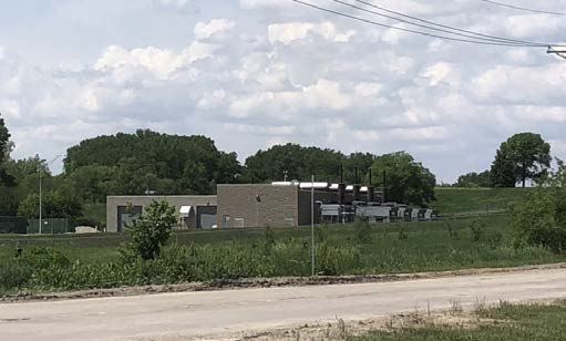
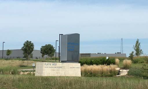
OPPD Generating Plant MUD Water Facility
Geographical Descriptor
The existing public facilities encompass the U.S. Air Force radar station and Army Reserve Training Center located in the north-central portion of the County’s jurisdiction, the MUD and Fremont wellfields, and Two Rivers State Park located in the southwest portion of the County.
Guiding Factors
These areas will remain in their existing use for the life of this plan and will likely not experience significant changes in use or operations. Expansion of these uses should protect environmental features and provide buffering from adjacent uses.
Principles and Patterns
- Future development adjacent to the County’s civic uses should not impair operations at these sites. Additionally, land uses adjacent to the MUD wellfields should be carefully reviewed for any effects the uses could have on groundwater and groundwater contamination. Further review of operations may also be required by the Papio- Missouri River NRD to identify water quality triggers and appropriate actions, in accordance with their Groundwater Management Plan.
Conclusions
An Interconnected System
The land use concepts presented in this chapter consider the desirable future for Douglas County. However, the
Development Areas described in this chapter are not isolated islands but instead create an interconnected community, linked by a system of roads, trails and open spaces. The transportation system should grow and expand with development creating a transportation web that includes:
- The grid of section line roads that function as the arterials, connecting the western portions of the County to the metropolitan area.
- A network of connected collector streets in the urban residential areas, providing connections from one development area to another and linking neighborhood parks and schools. These collectors become the connecting local fabric that provides inter-neighborhood access and prevents a default reliance on the arterial grid in the urban areas.
- A web of trails and pedestrian/bicycle pathways, utilizing streets, creeks and drainageways, and open spaces to provide continuous, non-motorized access throughout the developing County and connecting back into the larger metropolitan system.
- With the implementation of the above items along with high density development, public transit options should be part of the transportation system and connect people to jobs.
This Plan envisions an interlinked network of open spaces, creating an excellent living and working environment by assuring that significant green space is not far away. The open spaces should not be limited to those drainageways identified in chapter 2, but should include wetlands, prairies and other natural features identified on a site-bysite level. They should preserve and create a quality open space system through the development review process and cooperative efforts with municipal governments. It is not necessary for these areas to be publicly owned or operated as parks. Often the value of the open space can be as a wildlife habitat and corridor, for stormwater management, or simply visual quality and rhythm. Elements of this web of green spaces include:
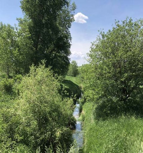
- The Floodway Area. The Floodways, mostly along the Elkhorn and Platte rivers, can be developed as public space, while much of the rest will remain in private ownership.
- Drainage corridors. These should be maintained as major open space corridors with adequate buffering and should generally include opportunities for trails and passive recreation.
- Omaha Suburban Parks Master Plan. A park system that assists in implementing the Omaha Suburban Parks Master Plan.
- Complete streets. Streets incorporating good landscaping and adjacent pathways.
The trail and pathway system should connect to both the Omaha metropolitan region trail system, extending the West Papio Trail to the Bennington area, and building on the Western Douglas County trail network. The key components of this system prpopsoed in the Western Douglas County Trail Plan include:
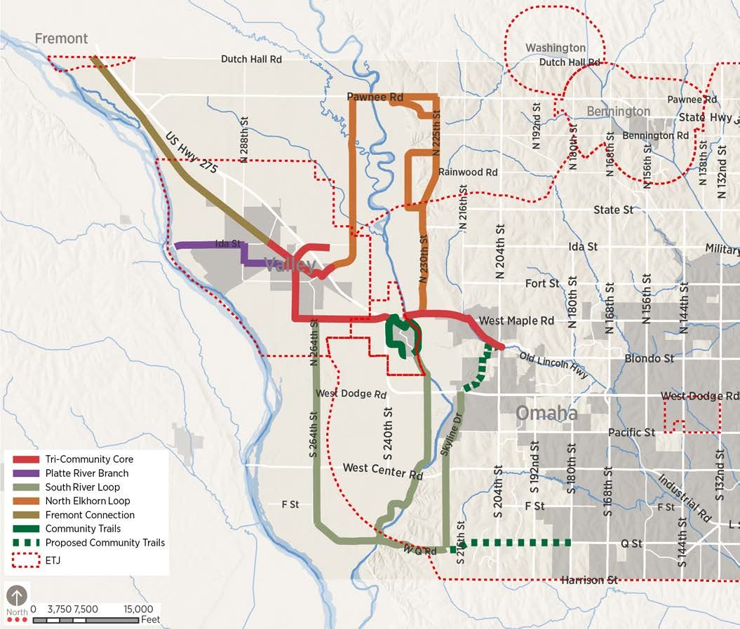
- The Tri-Community Core, linking the metropolitan trails system, Valley, Waterloo, and eventually Fremont.
- The North Elkhorn Loop, using County road corridors parallel to the Elkhorn River north to Pawnee Road (Highway 36).
- The South River Loop, utilizing 264th Street and West Q Street to provide a southern connection to the future metropolitan trails system at 180th Street.
- The Fremont connection along Reichmuth Road.
Population Potential
The urban land use strategy identified on the previous pages recommends that development occurs in concert with municipal water and sewer services. Generally this means that the land will develop as it is serviced by the City of Omaha or Bennington. As a result, the population of rural Douglas County is not expected to experience significant population or land development within its planning jurisdiction. Table 5.1 presents one scenario, but again most of this growth will likely occur in areas only after they are out of the County’s jurisdiction. Based on the minimum density scenarios and an estimated 2.5 people per household (2016 Douglas County) additional population growth could be up to 29,000. The Heartland 2050 Vision for the region support growth within existing cities and around existing commercial cores. This approach to growth is the most efficient for the region and will mean that County’s jurisdictional population will continue to account for a smaller proportion of the region’s population.
| Development Areas | Acres | Acres per Unit | Total Units | People Per Household | Total Population |
|---|---|---|---|---|---|
| Agriculture & Flood Plain | 14,742.5 | 80 | 184.3 | 2.52 | 464 |
| Preserve (Floodway) | 5,911.1 | -- | — | — | - |
| Public Service | 2,322.8 | -- | — | — | - |
| Venice Gateway Node | 72.9 | -- | — | — | - |
| Development Reserve | 2,525.9 | 80 | 31.6 | 2.52 | 80 |
| Urban Residential | 4,919.0 | 0.43 | 11,439.5 | 2.52 | 28,828 |
| Existing Residential | 2,734.2 | -- | — | — | — |
| Landfill Supporting Uses | 2,456.9 | -- | — | — | — |
| Total | — | — | 11,655.4 | — | 29,372 |
Source: RDG Planning & Design
Source: RDG Planning & Design