

Douglas County, Nebraska’s most populous County, adopted comprehensive plans in 1998 and 2006 for the area outside of municipal jurisdictions. These documents recognized the annexation policies of Omaha, Bennington, and Valley as well as their impact on the County’s planning jurisdiction. Nevertheless, they emphasized the importance of the County comprehensive plan in “helping to define the character of the leading edge of metropolitan growth, preserving vital environmental resources and agricultural lands, and discouraging unstructured development in rural areas and on the urban fringe of the metropolitan area.” This fundamental mission of the County comprehensive plan remains as valid today as it did in both 1998 and 2006. The following document builds on the 2006 plan, to include new opportunities and economic trends.
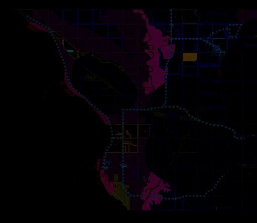
1998 Douglas County Land Use Plan 2006 Douglas County Land Use Plan
The 2006 Douglas County Comprehensive Plan
The 2006 Plan was built around 14 basic principles. Those principles emphasized:
- Protection of the environment and natural resources such as the Elkhorn and Platte floodplains and the bluffs of the Elkhorn River valley
- Areas within reach of urban services would be reserved for urban density development
- All projects would use low impact or conservation development techniques
- Stormwater management techniques would focus on onsite retention and distribution
Neither the 1998 nor the 2006 plans anticipated extension of municipal utilities into the County jurisdiction. The most significant change between the 1998 and 2006 plan was the establishment of conservation or low-impact site design standards for all projects. Under this requirement, sensitive areas such as floodplains and wetlands have to be preserved and a certain percentage of a development must remain as open space. The goal of this policy was to ensure that the area’s rural character remained strong and that stormwater could be managed in a more efficient and effective manner.
Since 1998 and 2006, changes have occurred in both the development and physical trends that raise new policy and design issues. These include:
- The Great Recession. Events since 2008 changed the nature of residential development. The recession and entrance of Millennials into the housing market decreased demand for large lot and acreage development, typically with densities below one unit per acre. Demand for this type of development was strong in both 2006 and 1998 and typically occurred on the fringes of municipal jurisdictions, just inside the County’s jurisdiction.
- Emphasis on timing development. The 2006 Plan’s clear desire to ensure that development occurred at the right time, when services could be provided, slowed the pace of development demand. Additionally, changing policies in surrounding counties made it easier and more appealing to develop acreage developments outside Douglas County.
- Changing municipal jurisdictions. The annexation case between the cities of Omaha and Elkhorn significantly decreased the amount of land within the County’s planning jurisdiction.
- Increasing awareness of stormwater management. A particularly important aspect of development design includes stormwater management practices that include the mandates imposing water quality standards on stormwater discharge. In addition, increases in the volume of stormwater runoff from additional development can affect downstream areas.
Standards for excellence in County development should address environmental concerns such as stormwater management, wastewater treatment, development design, and community character.
- Transportation, urban infrastructure, and recreation. All of these have evolved over the past 20 years. The expansion of the arterial system slowed with the recession, and demand for more trails remained strong. New forms of recreation also emerged, with hundreds of people canoeing and floating down the Elkhorn River every weekend. These activities expose more residents to the natural beauty of Douglas County, but they also create increased awareness of the interaction between residents along greenways and those enjoying the greenways.
Methodology
Due to the special nature of planning in Douglas County, an increasingly limited land supply, changing municipal jurisdictions, specific policies established by adopted city comprehensive plans, and demonstrated growth demands traditional methodologies (such as population projections and allocation of urban land conversion needs) have limited usefulness. In view of metropolitan growth demands, this comprehensive plan addresses how to make the best use of available land resources, given development demands and environmental characteristics. In common with the 1998 Douglas County Comprehensive Plan, this plan draws on the work of the landscape architect and environmental planner Ian McHarg to overlay environmental constraints and opportunities. This technique is used to define appropriate policies for specific development districts. The plan’s methodology also reviewed and validated the 2006 community input process through surveys and small group discussions.
Much of the 2006 Plan remained true and valid, and therefore strategic updates were made with the core chapters remaining intact.
- Chapter 1. Land Use and Land Use Trends. This chapter reviews land use patterns and trends within the County’s planning jurisdiction.
- Chapter 2. Environmental and Development Resources. This chapter considers those features that add value to the environment of the County’s planning jurisdiction or affect the course of future growth. It also examines infrastructure, including transportation and utility systems.
- Chapter 3. Stakeholder Issues. This chapter summarizes the findings of the community participation process and identifies key issues and perspectives identified by stakeholders (including builders and developers, engineers, public officials, property owners, and neighbors).
- Chapter 4. First Principles. This chapter establishes the policy principles that guide the land use plan and should be used as criteria in evaluating development proposals.
- Chapter 5. Land Use Plan. This chapter presents the County land use concept, along with land use policies for the County planning jurisdiction. It is built on the concept of development policy districts, guiding future private and public development decisions and investments.
- Chapter 6. Transportation, Infrastructure, and Public Facilities. This chapter addresses public improvements that support the concepts of the land use plan.
- Chapter 7. Plan Implementation. This chapter provides guidance and describes techniques for implementing key aspects of the plan.
The plan also includes an extensive Appendix that presents the Energy Element and a review of Best Development Practices - a variety of design techniques that should be incorporated into the design of new developments.
*References to “The County” mean the Douglas County Planning and Zoning jurisdiction unless otherwise noted.